Back نهر كين ARZ Riu Ken Catalan Ken River CEB Ken (Fluss) German Río Ken Spanish Ken (cours d'eau) French કેન નદી Gujarati केन नदी Hindi केन नदी MAI केन नदी Nepali
| Ken River | |
|---|---|
 Ken river | |
| Location | |
| Country | India |
| State | Madhya Pradesh, Uttar Pradesh |
| Region | Bundelkhand |
| Physical characteristics | |
| Source | Ahirgawan |
| • location | Kaimur Range, Katni district, Madhya Pradesh |
| • elevation | 550 m (1,800 ft) |
| Mouth | Yamuna River |
• location | Chilla Ghat, Banda district, Uttar Pradesh |
• coordinates | 25°46′N 80°31′E / 25.767°N 80.517°E |
| Length | 427 km (265 mi) |
| Discharge | |
| • average | 310 m3/s (11,000 cu ft/s)[1] |
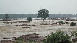
The Ken River is one of the major rivers in the Bundelkhand region of central India and flows through the states of Madhya Pradesh and Uttar Pradesh. It is a tributary of the Yamuna.
- ^ "Hydrology" (PDF). nwda.gov.in. National Water Development Authority. Retrieved 22 April 2014.
