Back كينت (أوهايو) Arabic كينت (بورتج, اوهايو) ARZ کنت، اوهایو AZB Кент (Агая) Byelorussian কেন্ট, ওহাইও Bengali/Bangla Kent (Ohio) Catalan Кент (Огайо) CE Kent (lungsod sa Tinipong Bansa, Ohio) CEB Kent (Ohio) Czech Kent, Ohio Welsh
Kent, Ohio | |
|---|---|
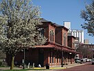
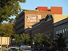
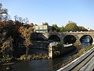
Top from left: old Erie Depot and Star of the West mill, Franklin Hotel, Dix Stadium, Theodore Roosevelt High School, Kent Hall, Main Street Bridge and arch dam, Cuyahoga River | |
| Nickname: The Tree City | |
 Interactive map of Kent | |
| Coordinates: 41°08′57″N 81°21′39″W / 41.14917°N 81.36083°W[1] | |
| Country | United States |
| State | Ohio |
| County | Portage |
| Founded | November 1805 |
| Incorporated | 1867 |
| Founded by | John Haymaker |
| Named for | Marvin Kent |
| Government | |
| • Type | Council-Manager |
| • City Manager | Dave Ruller |
| • Mayor | Jerry Fiala (I) |
| Area | |
• Total | 9.33 sq mi (24.17 km2) |
| • Land | 9.22 sq mi (23.89 km2) |
| • Water | 0.11 sq mi (0.28 km2) |
| Elevation | 1,056 ft (322 m) |
| Population (2020) | |
• Total | 28,215 |
| • Density | 3,059.53/sq mi (1,181.23/km2) |
| Demonym | Kentite |
| Time zone | UTC−5 (EST) |
| • Summer (DST) | UTC−4 (EDT) |
| ZIP codes | 44240, 44242, 44243 |
| Area codes | 330, 234 |
| FIPS code | 39-39872 |
| GNIS feature ID | 2395512[1] |
| Website | kentohio |
Kent is a city in the U.S. state of Ohio and the largest city in Portage County. It is located along the Cuyahoga River in Northeast Ohio on the western edge of the county. The population was 28,215 at the 2020 Census.[3] The city is counted as part of the Akron metropolitan area and the larger Cleveland–Akron–Canton combined statistical area.
Part of the Connecticut Western Reserve, Kent was settled in 1805 and was known for many years as Franklin Mills. Settlers were attracted to the area due to its location along the Cuyahoga River as a place for water-powered mills. Later development came in the 1830s and 1840s as a result of the settlement's position along the route of the Pennsylvania and Ohio Canal. Leading up to the American Civil War, Franklin Mills was noted for its activity in the Underground Railroad. With the decline of the canal and the emergence of the railroad, the town became the home of the Atlantic and Great Western Railroad maintenance shops through the influence of Marvin Kent. In 1864 the town was renamed Kent in honor of and in gratitude for Marvin Kent's efforts. It was incorporated as a village in 1867 and became a city after the 1920 Census. Today Kent is a college town best known as the home of the main campus of Kent State University, founded in 1910, and as the site of the May 4, 1970 Kent State shootings.
Historically a manufacturing center, education is the city's largest economic sector with Kent State University being the city's, and one of the region's, largest employers. The Kent City School District and the Kent Free Library provide additional education opportunities and resources. Many of Kent's demographic elements are influenced by the presence of the university, particularly the median age, median income, and those living below the poverty level. The city is governed by a council-manager system with a city manager, a nine-member city council, and a mayor. Kent has nearly 20 parks and preserves and hosts a number of annual festivals including ones related to Earth Day, folk music, and the U.S. Independence Day. In addition to the Kent State athletic teams, the city also hosts a number of amateur and local sporting events at various times during the year. Kent is part of the Cleveland–Akron media market and is the city of license for three local radio stations and three television stations and includes the regional affiliates for National Public Radio (NPR) and the Public Broadcasting Service (PBS). Local transportation infrastructure includes a public bus service and hike-and-bike trails. As the home of the Davey Tree Expert Company, Kent is known as "The Tree City" while residents are referred to as "Kentites". The city has produced a number of notable individuals, particularly in politics, athletics, and the entertainment industry.
- ^ a b c U.S. Geological Survey Geographic Names Information System: Kent, Ohio
- ^ "ArcGIS REST Services Directory". United States Census Bureau. Retrieved September 20, 2022.
- ^ "Census - Geography Profile: Kent city, Ohio". Retrieved January 12, 2022.


