Back كيستون (فيرجينيا الغربية) Arabic كيستون (ويست ڤيرچينيا) ARZ کئیستون، باتی ویرجینیا AZB Keystone (Virgínia de l'Oest) Catalan Кистоун (Малхбузен Вирджини) CE Keystone (lungsod sa Tinipong Bansa, West Virginia, McDowell County) CEB Κίστοουν (Δυτική Βιρτζίνια) Greek Keystone (Virginia Occidental) Spanish Keystone (Mendebaldeko Virginia) Basque کیستوون، ویرجینیای غربی Persian
Keystone, West Virginia | |
|---|---|
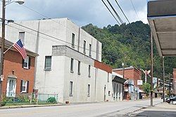
 U.S. Route 52 in the city's southwest | |
 Location of Keystone in McDowell County, West Virginia. | |
| Coordinates: 37°24′54″N 81°26′46″W / 37.41500°N 81.44611°W | |
| Country | United States |
| State | West Virginia |
| County | McDowell |
| Government | |
| • Mayor | Dennis Robertson |
| Area | |
• Total | 0.32 sq mi (0.84 km2) |
| • Land | 0.32 sq mi (0.84 km2) |
| • Water | 0.00 sq mi (0.00 km2) |
| Elevation | 1,631 ft (497 m) |
| Population | |
• Total | 282 |
• Estimate (2019)[3] | 223 |
| • Density | 688.27/sq mi (265.98/km2) |
| Time zone | UTC-5 (Eastern (EST)) |
| • Summer (DST) | UTC-4 (EDT) |
| ZIP code | 24852 |
| Area code | 304 |
| FIPS code | 54-43516 |
| GNIS feature ID | 1554871[4] |
| Website | https://local.wv.gov/keystone/Pages/default.aspx |
Keystone is a city in McDowell County, West Virginia, United States. Per the 2020 census, the population was 176.[5] Keystone is one of the few municipalities in West Virginia with an African-American majority, with 65 percent of the residents being black.
The term "Free State of McDowell" was coined by Matthew Thomas Whittico, a local newspaper editor and community leader from Keystone in the early 20th century.[6] Keystone possessed a unique combination of political, social, and economic characteristics that made it an attractive place for African-Americans to migrate to in the late 1800s and early 1900s.[6]
- ^ "2019 U.S. Gazetteer Files". United States Census Bureau. Retrieved August 7, 2020.
- ^ Cite error: The named reference
wwwcensusgovwas invoked but never defined (see the help page). - ^ Cite error: The named reference
USCensusEst2019CenPopScriptOnlyDirtyFixDoNotUsewas invoked but never defined (see the help page). - ^ "US Board on Geographic Names". United States Geological Survey. October 25, 2007. Retrieved January 31, 2008.
- ^ "Keystone city, West Virginia". United States Census Bureau. Retrieved April 15, 2022.
- ^ a b Deaner, Larry Scott (2004). Home in the McDowell County Coalfields: The African-American Population of Keystone, West Virginia (M.A., Geography thesis). Ohio University.