Back كينغزبري Arabic Kingsbury (Londres) French Kingsbury Irish किंग्सबरी Hindi Kingsbury Hungarian Kingsbury NB کنگزبری، لندن Urdu 金斯伯里 Chinese
| Kingsbury | |
|---|---|
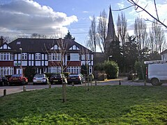
 St Andrews Road and Church, Kingsbury | |
Location within Greater London | |
| Area | 5.63 km2 (2.17 sq mi) |
| Population | 29,217 |
| • Density | 5,190/km2 (13,400/sq mi) |
| OS grid reference | TQ195885 |
| London borough | |
| Ceremonial county | Greater London |
| Region | |
| Country | England |
| Sovereign state | United Kingdom |
| Post town | LONDON |
| Postcode district | NW9 |
| Dialling code | 020 |
| Police | Metropolitan |
| Fire | London |
| Ambulance | London |
| UK Parliament | |
| London Assembly | |
Kingsbury is a district of northwest London in the London Borough of Brent. Its ancient scope stretches to include various distinct areas that were once small villages until the inter-war period. Kingsbury was in 2001 a ward and in 2011 was identifiable with the Fryent and Barnhill wards approximately. Today it forms a quiet suburb between Fryent Country Park to the west and the Brent Reservoir to the east, along with a tube station of the same name and accompanying shopping district on the western side. The postal district is NW9 which it shares with Colindale and West Hendon.
