Back کیرووسک، روسیه AZB Кіраўскэ (Кіраўскі раён) Byelorussian Ісьлям-Тэрэк BE-X-OLD Kírovske (Crimea) Catalan İslâm Terek CRH Kirowske (Kirowske) German Kirovsko (Kirovska distrikto, Krimeo) Esperanto Kírovske Spanish Kirovske (Crimée) French Կիրովսկոե (քաղաքատիպ ավան, Ղրիմ) Armenian
Kirovske / Isliam-Terek
Іслям-Терек — Ислям-Терек — İslâm Terek | |
|---|---|
 | |
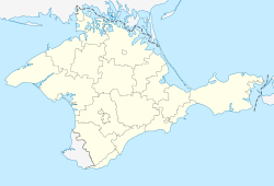
| Coordinates: 45°13′25″N 35°12′19″E / 45.22361°N 35.20528°E | |
| Republic | Crimea |
| District | Kirovske Raion |
| First mentioned | 1783 |
| Town status | 1957 |
| Government | |
| • Mayor | Aleksandr Evseyev[1] |
| Area | |
• Total | 5.99 km2 (2.31 sq mi) |
| Elevation | 23 m (75 ft) |
| Population (2014) | |
• Total | 6,883 |
| • Density | 1,100/km2 (3,000/sq mi) |
| Time zone | UTC+4 (MSK) |
| Postal code | 297300 |
| Area code | +7 365 55 |
| Climate | Cfa |
| Website | http://rada.gov.ua/[permanent dead link] |
 | |
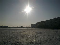
Kirovske (Ukrainian: Кіровське; Russian: Кировское, romanized: Kirovskoye) or Isliam-Terek (Ukrainian: Іслям-Терек; Russian: Ислям-Терек; Crimean Tatar: İslâm Terek) is an urban-type settlement in the Crimea, a territory recognized by a majority of countries as part of Ukraine and occupied by Russia as the Republic of Crimea. Population: 6,883 (2014 Census).[3]
Kirovske also serves as the administrative center of the Kirovske Raion (district), housing the district's local administration buildings.[4]
A military air base, Kirovske, is located south of the town. It was used extensively by Soviet Naval Aviation and Soviet Air Defense Forces during the Cold War.
As of the 2001 Ukrainian Census, its population was 7,431.[4]
- ^ "Aleksandr Evseyev Elected as Mayor of Kirovskoye" (in Russian). Retrieved 25 October 2018.
- ^ "Kirovske (Crimea, Kirovske Raion)". weather.in.ua (in Ukrainian). Retrieved 14 February 2012.
- ^ Russian Federal State Statistics Service (2014). "Таблица 1.3. Численность населения Крымского федерального округа, городских округов, муниципальных районов, городских и сельских поселений" [Table 1.3. Population of Crimean Federal District, Its Urban Okrugs, Municipal Districts, Urban and Rural Settlements]. Федеральное статистическое наблюдение «Перепись населения в Крымском федеральном округе». ("Population Census in Crimean Federal District" Federal Statistical Examination) (in Russian). Federal State Statistics Service. Retrieved January 4, 2016.
- ^ a b "Kirovske, Autonomous Republic of Crimea, Kirovske Raion". Regions of Ukraine and their Structure (in Ukrainian). Verkhovna Rada of Ukraine. Retrieved 14 February 2012.[permanent dead link]


