Back كوداجو Arabic كوداجو ARZ कोडगु जिला Bihari কোড়গু জেলা Bengali/Bangla Districte de Kodagu Catalan Kodagu CEB Kodagu (Distrikt) German Kodagu Esperanto Distrito de Kodagu Spanish Kodagu barrutia Basque
Kodagu district
Coorg district, Kodava Naad (Kodava language) | |
|---|---|
Clockwise from top-left: Tadiandamol, Tibetian Golden Temple, Resort view from Tadiandamol , Kumara Parvatha, Harangi Elephant Camp & Tree Park and Abbey Falls, Mandalpatti hill an 18km roadway from Medikeri | |
| Nicknames: The Scotland of India, The Land of Warriors, The Coffee Cup of India | |
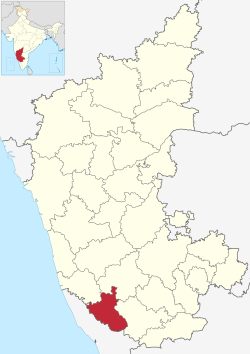
 Location in Karnataka | |
| Coordinates: 12°25′15″N 75°44′23″E / 12.4208°N 75.7397°E | |
| Country | |
| State | Karnataka |
| Division | Mysuru |
| Region | Malenadu |
| Haleri Dynasty | early 17th century |
| Coorg Province | May 1834 |
| Coorg State | August 15, 1947 |
| Kodagu district | November 1, 1956 |
| Headquarters | Madikeri |
| Talukas | Madikeri, Virajpet, Somwarpet, Ponnampet, Kushalanagar |
| Government | |
| • Deputy Commissioner | Venkat Raja (IAS) |
| • MP | Yaduveer Wadiyar |
| • MLA |
|
| Area | |
• Total | 4,102 km2 (1,584 sq mi) |
| • Rank | 26th (31 districts) |
| Elevation (Avg. of 5 taluks) | 984 m (3,228 ft) |
| Population (2011)[2] | |
• Total | 554,519 |
| • Rank | 31st (31 districts) |
| • Density | 140/km2 (350/sq mi) |
| Demonym(s) | Kodava, Kodagaru, Coorgi |
| Languages | |
| • Official | Kannada Kodava [3] |
| Time zone | UTC+5:30 (IST) |
| PIN | 571201 (Madikeri) |
| Telephone code |
|
| Vehicle registration | KA-12 |
| Literacy | 82.52% |
| Lok Sabha | Mysore Lok Sabha constituency |
| Karnataka Legislative Assembly constituency | Madikeri, Virajpet |
| Climate | Tropical Wet (Köppen) |
| Precipitation | 2,725.5 millimetres (107.30 in) |
| Avg. summer temperature | 28.6 °C (83.5 °F) |
| Avg. winter temperature | 14.2 °C (57.6 °F) |
| Website | kodagu |
| Part of a series on the |
| Culture of Karnataka |
|---|
 |
Kodagu district (Kodava: [koɖɐɡɨ]) (also known by its former name Coorg) is an administrative district in the Karnataka state of India. Before 1956, it was an administratively separate Coorg State at which point it was merged into an enlarged Mysore State.[4][5]

- ^ "Kodagu district Profile". DSERT. Retrieved 11 January 2011.
- ^ Cite error: The named reference
districtcensuswas invoked but never defined (see the help page). - ^ "Kodagu District Population Census 2011-2021, Karnataka literacy sex ratio and density".
- ^ Kushalappa, Mookonda (2013). Long ago in Coorg. USA. pp. 356–365. ISBN 9781494282479.
{{cite book}}: CS1 maint: location missing publisher (link) - ^ Ponnathpur, Rakshith S. (12 August 2020). "When Kodagu merged with Mysore: A short political history of the region". The News Minute. Retrieved 18 December 2024.


