Back La Longeville AST La Longeville Catalan Ла-Лонжвиль CE La Longeville CEB La Longeville German Λα Λονζβίλ Greek La Longeville Esperanto La Longeville Spanish La Longeville Basque La Longeville French
La Longeville | |
|---|---|
Part of Pays-de-Montbenoît | |
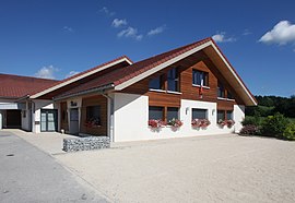
 The town hall in La Longeville | |
| Coordinates: 47°00′30″N 6°27′29″E / 47.0083°N 6.4581°E | |
| Country | France |
| Region | Bourgogne-Franche-Comté |
| Department | Doubs |
| Arrondissement | Pontarlier |
| Canton | Ornans |
| Commune | Pays-de-Montbenoît |
Area 1 | 15.66 km2 (6.05 sq mi) |
| Population (2022)[1] | 844 |
| • Density | 54/km2 (140/sq mi) |
| Time zone | UTC+01:00 (CET) |
| • Summer (DST) | UTC+02:00 (CEST) |
| Postal code | 25650 |
| Elevation | 756–991 m (2,480–3,251 ft) |
| 1 French Land Register data, which excludes lakes, ponds, glaciers > 1 km2 (0.386 sq mi or 247 acres) and river estuaries. | |
La Longeville (French pronunciation: [la lɔ̃ʒvil]) is a former commune in the Doubs department in the Bourgogne-Franche-Comté region in eastern France. It was merged into the new commune Pays-de-Montbenoît on 1 January 2025.[2]
- ^ "Populations de référence 2022" [Reference populations 2022] (PDF) (in French). INSEE. December 2024.
- ^ Arrêté du 25 septembre 2024 portant création de la commune nouvelle de Pays-de-Montbenoît, Légifrance, retrieved 13 January 2025


