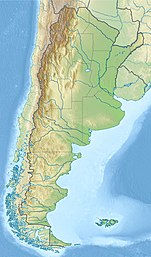
| Laguna Socompa | |
|---|---|
 | |
| Coordinates | 24°31′27″S 68°12′26″W / 24.52417°S 68.20722°W |
| Surface area | 2 square kilometres (0.77 sq mi) |
| Average depth | 0.45–0.62 metres (1 ft 6 in – 2 ft 0 in) |
| Shore length1 | 5 kilometres (3.1 mi) |
| Surface elevation | 3,570 metres (11,710 ft) |
| 1 Shore length is not a well-defined measure. | |
Laguna Socompa is a small lake in the Salta Province of Argentina, at the foot of Socompa volcano. It covers an area of about 200 hectares (490 acres) and has an average depth of about 0.45–0.62 metres (1 ft 6 in – 2 ft 0 in). The lake is fed by arroyos and springs, some of which are hot springs. Its waters are very rich in arsenic and otherwise salty and slightly alkaline; these properties and the regionally high UV radiation give Laguna Socompa extreme environmental conditions.
The lake features the world's highest known stromatoliths, mineralized structures formed by microorganisms. Stromatolith-forming microbes were the dominant lifeforms on Earth fossilized between 3.5 and 1.5 billion years ago and may give insight on early life on Earth. These stromatoliths are found on the southern shore of the lake and led to Laguna Socompa being declared a protected area.

