Back بحيره بوراجورانج ARZ Lake Burragorang (lanaw) CEB Lake Burragorang German Burragorang Esperanto Lake Burragorang Swedish 布拉格兰湖 Chinese
| Lake Burragorang | |
|---|---|
 The lake in January 2014 | |
| Coordinates | 34°0′S 150°26′E / 34.000°S 150.433°E |
| Type | Man-made water supply dammed reservoir |
| Primary inflows | Coxs, Kowmung, Nattai, Wingecarribee, Wollondilly and Warragamba rivers |
| Primary outflows | Warragamba River |
| Catchment area | 9,051 km2 (3,495 sq mi) |
| Basin countries | Australia |
| Max. length | 52 km (32 mi) |
| Surface area | 75 km2 (29 sq mi) |
| Max. depth | 105 m (344 ft) |
| Water volume | 2,031 GL (4.47×10¹¹ imp gal; 5.37×10¹¹ US gal) |
| Shore length1 | 354 km (220 mi) |
| Surface elevation | 110 m (360 ft) |
| 1 Shore length is not a well-defined measure. | |
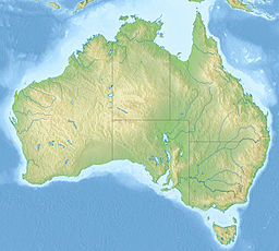
Lake Burragorang is a man-made reservoir in the lower Blue Mountains of New South Wales, Australia, serving as a major water supply for greater metropolitan Sydney. The dam impounding the lake, the Warragamba Dam, is located approximately 60 kilometres (37 mi) southwest of the Sydney central business district.
Lake Burragorang is within the World Heritage Site of the Greater Blue Mountains Area. The 2,031-gigalitre (4.47×10¹¹ imp gal; 5.37×10¹¹ US gal) reservoir collects water from the converged flows of the Coxs, Kowmung, Nattai, Wingecarribee, Wollondilly, and Warragamba rivers and their associated tributaries, all within the Nepean and Hawkesbury River catchment.

