Back Lanterne German Lanterne (affluent de la Saône) French Lanterne (fiume) Italian Lanterne Polish Лантерн Russian Лантерн Serbian 朗泰讷河 Chinese
47°47′48″N 6°32′12″E / 47.7967°N 6.53667°E
| Lanterne | |
|---|---|
 The Lanterne at Lantenot | |
 | |
| Native name | La Lanterne (French) |
| Location | |
| Country | France |
| Physical characteristics | |
| Source | |
| • location | Parc naturel régional des Ballons des Vosges |
| • elevation | 430 m (1,410 ft) |
| Mouth | |
• location | Saône |
• elevation | 216 m (709 ft) |
| Length | 64.3 km (40.0 mi) |
| Basin size | 1,020 km2 (390 sq mi) |
| Discharge | |
| • average | 22.1 m3/s (780 cu ft/s) |
| Basin features | |
| Progression | Saône→ Rhône→ Mediterranean Sea |
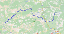
The Lanterne (French pronunciation: [lɑ̃tɛʁn] ⓘ) is a river in the east of France, a substantial left tributary of the Saône, and sub-tributary of the Rhône. It is 64.3 km (40.0 mi) long.[1]