Back جزيرة ليمباتا Arabic Лембата Byelorussian Ломблен Bulgarian Pulau Kawula CEB Lembata German Lembata Spanish Lembata French Lembata Galician Kabupaten Lembata ID Lembata Italian
Native name: Pulau Lembata | |
|---|---|
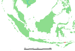
 Location in Indonesia | |
| Geography | |
| Location | Lesser Sunda Islands |
| Coordinates | 8°24′S 123°34′E / 8.40°S 123.57°E |
| Area | 1,266.39 km2 (488.96 sq mi) |
| Highest elevation | 1,621 m (5318 ft) |
| Highest point | Ile Labalekang |
| Administration | |
| Province | East Nusa Tenggara |
| Regency | Lembata Regency |
| Largest settlement | Lewoleba (pop. 40,200) |
| Demographics | |
| Population | 135,930 (2020 Census) |
| Pop. density | 107.34/km2 (278.01/sq mi) |
Lembata is an island in the Lesser Sunda Islands, also known as Lomblen island; it is the largest island of the Solor Archipelago, in the Lesser Sunda Islands, Indonesia. It forms a separate regency of the province of Nusa Tenggara Timur. The island has a very irregular coastline with numerous bays and promontories, of which the largest is the Ile Ape peninsula on the island's north coast. The length of the island is about 80 km from the southwest to the northeast and the width is about 30 km from the west to the east. It rises to an elevation of 1,621 metres at Mount Ile Labalekang.
To the west lie the other islands in the archipelago, most notably Solor and Adonara in the East Flores Regency, and then the larger island of Flores. To the east is the Alor Strait, which separates this archipelago from the Alor Archipelago. To the south across the Savu Sea lies the island of Timor, while to the north the western branch of the Banda Sea separates it from Buton and the other islands of Southeast Sulawesi.