Back ينيكسا Arabic ينيكسا ARZ Lenexa Catalan Ленекса (Канзас) CE Lenexa CEB لینێکسا CKB Lenexa German Lenexa Spanish Lenexa (Kansas) Basque لنکسا، کانزاس Persian
Lenexa, Kansas | |
|---|---|
 Lenexa City Center (2017) | |
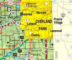
 Location within Johnson County and Kansas | |
 | |
| Coordinates: 38°57′58″N 94°44′02″W / 38.96611°N 94.73389°W[1] | |
| Country | United States |
| State | Kansas |
| County | Johnson |
| Incorporated | 1907 |
| Government | |
| • Mayor | Julie Sayers |
| • City Manager | Beccy Yocham |
| Area | |
• Total | 34.39 sq mi (89.08 km2) |
| • Land | 34.07 sq mi (88.24 km2) |
| • Water | 0.32 sq mi (0.83 km2) 1.02% |
| Elevation | 873 ft (266 m) |
| Population | |
• Total | 57,434 |
| • Density | 1,700/sq mi (640/km2) |
| Time zone | UTC-6 (CST) |
| • Summer (DST) | UTC-5 (CDT) |
| ZIP codes | 66200-66299 |
| Area code | 913 |
| FIPS code | 20-39350 |
| GNIS ID | 485612[1] |
| Website | lenexa.com |
Lenexa /lɪˈnɛksə/ is a city in Johnson County, Kansas, United States,[1] and part of the Kansas City metropolitan area. As of the 2020 census, the population of the city was 57,434.[3][4] making it the 9th most populated city in Kansas.[5][6] It is bordered by the cities of Shawnee to the north, Overland Park to the east, De Soto to the west and Olathe to the south.
- ^ a b c d U.S. Geological Survey Geographic Names Information System: Lenexa, Kansas
- ^ "2019 U.S. Gazetteer Files". United States Census Bureau. Retrieved July 24, 2020.
- ^ a b "Profile of Lenexa, Kansas in 2020". United States Census Bureau. Archived from the original on November 23, 2022. Retrieved November 22, 2022.
- ^ a b "QuickFacts; Lenexa, Kansas; Population, Census, 2020 & 2010". United States Census Bureau. Archived from the original on August 24, 2021. Retrieved August 23, 2021.
- ^ "PRINCIPAL CITIES OF METROPOLITAN AND MICROPOLITAN STATISTICAL AREAS, MARCH 2020".
- ^ "The Demographic Statistical Atlas of the United States - Statistical Atlas". Archived from the original on December 9, 2015.