Back Levanger ANG ليفانغر Arabic Левангер Byelorussian Левангер Bulgarian লেভাঙের BPY Levanger Catalan Levanger (munisipyo) CEB Levanger Danish Levanger German Levanger Esperanto
Levanger Municipality
Levanger kommune | |
|---|---|
 | |
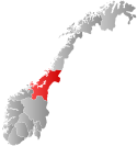
 Trøndelag within Norway | |
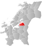
 Levanger within Trøndelag | |
| Coordinates: 63°39′17″N 11°15′37″E / 63.65472°N 11.26028°E | |
| Country | Norway |
| County | Trøndelag |
| District | Innherred |
| Established | 1 Jan 1838 |
| • Created as | Formannskapsdistrikt |
| Administrative centre | Levanger |
| Government | |
| • Mayor (2019) | Anita Ravlo Sand (Sp) |
| Area | |
• Total | 645.80 km2 (249.34 sq mi) |
| • Land | 609.74 km2 (235.42 sq mi) |
| • Water | 36.06 km2 (13.92 sq mi) 5.6% |
| • Rank | #174 in Norway |
| Highest elevation | 735.35 m (2,412.57 ft) |
| Population (2024) | |
• Total | 20,574 |
| • Rank | #64 in Norway |
| • Density | 31.9/km2 (83/sq mi) |
| • Change (10 years) | |
| Demonym | Levangsbygg[2] |
| Official language | |
| • Norwegian form | Neutral |
| Time zone | UTC+01:00 (CET) |
| • Summer (DST) | UTC+02:00 (CEST) |
| ISO 3166 code | NO-5037[4] |
| Website | Official website |
Levanger is a municipality in Trøndelag county, Norway. It is part of the district of Innherred. The administrative centre of the municipality is the town of Levanger. Some of the notable villages in the municipality include Alstadhaug, Ekne, Hokstad, Markabygda, Momarka, Mule, Nesset, Okkenhaug, Ronglan, Skogn, and Åsen.
The town of Levanger lies at the mouth of the Levangselva river along the Trondheimsfjord. One of the main roads through the town is Kirkegata. The 5-square-kilometre (1.9 sq mi) town has a population (2024) of 10,813, meaning about half the municipal residents live in the town.[5] The town has held "town status" as of 1997 and houses a campus of the Nord University as of 2016.
The 646-square-kilometre (249 sq mi) municipality is the 174th largest by area out of the 357 municipalities in Norway. Levanger is the 64th most populous municipality in Norway with a population of 20,574. The municipality's population density is 31.9 inhabitants per square kilometre (83/sq mi) and its population has increased by 7.1% over the previous 10-year period.[6][7]
Levanger is a member of the Italian initiative, Cittaslow, for slow towns that don't adopt a "fast-lane" approach that is so common in most modern towns.
- ^ "Høgaste fjelltopp i kvar kommune" (in Norwegian). Kartverket. 16 January 2024.
- ^ "Navn på steder og personer: Innbyggjarnamn" (in Norwegian). Språkrådet.
- ^ "Forskrift om målvedtak i kommunar og fylkeskommunar" (in Norwegian). Lovdata.no.
- ^ Bolstad, Erik; Thorsnæs, Geir, eds. (9 January 2024). "Kommunenummer". Store norske leksikon (in Norwegian). Foreningen Store norske leksikon.
- ^ Statistisk sentralbyrå (1 October 2024). "Urban settlements. Population and area, by municipality".
- ^ Statistisk sentralbyrå. "Table: 06913: Population 1 January and population changes during the calendar year (M)" (in Norwegian).
- ^ Statistisk sentralbyrå. "09280: Area of land and fresh water (km²) (M)" (in Norwegian).

