Back Libreville Afrikaans Libreville ALS ሊብረቪል Amharic Libreville AN ليبرفيل Arabic ليبرفيل ARZ Libreville AST Libreville AVK Librevil Azerbaijani لیبرویل AZB
This article needs additional citations for verification. (April 2024) |
Libreville | |
|---|---|
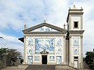
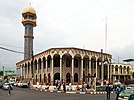
Boulevard du nord, Palais du Sénat, Gabon Mining Logistics building, Church of Notre-Dame de Lourdes, The Mosquée du CHU (Centre Hospitalier Universitaire), Bay of the Cap | |
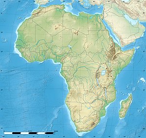
| Coordinates: 0°23′25″N 9°27′15″E / 0.39028°N 9.45417°E | |
| Country | Gabon |
| Province | Estuaire Province |
| Capital district | Libreville |
| Area | |
| • Land | 65.42 km2 (25.26 sq mi) |
| • Metro | 189 km2 (73 sq mi) |
| Population (2013 census) | |
| 703,904 | |
| Time zone | UTC+01:00 (West Africa Time) |
| • Summer (DST) | (Not Observed) |
| HDI (2018) | 0.788[1] high |
| Website | www |
Libreville (/ˈlibrəˌvil/;[2] French: [libʁəvil]) is the capital and largest city of Gabon, located on the Gabon Estuary. Libreville occupies 65 square kilometres (25 sq mi) of the northwestern province of Estuaire. Libreville is also a port on the Gabon Estuary, near the Gulf of Guinea. As of the 2013 census, its population was 703,904.[3]
The area has been inhabited by the Mpongwe people since before the French acquired the land in 1839. It was later an American Christian mission, and a slave resettlement site, before becoming the chief port of the colony of French Equatorial Africa. By the time of Gabonese independence in 1960, the city was a trading post and minor administrative centre with a population of 32,000. Since 1960, Libreville has grown rapidly and now is home to one-third of the national population.
- ^ "Sub-national HDI – Area Database – Global Data Lab". hdi.globaldatalab.org. Retrieved 13 September 2018.
- ^ "LIBREVILLE definition and meaning | Collins English Dictionary"".
- ^ "GeoHive – Gabon". 22 October 2015. Archived from the original on 6 September 2011.


