Back Lower Paxton Township, Pennsylvania Welsh Municipio de Lower Paxton Spanish Lower Paxton Township French ローワー・パクストン郡区 (ペンシルベニア州ドーフィン郡) Japanese Ловер-Пакстон Тауншип (округ Дофін, Пенсільванія) Ukrainian لوئر پیکسٹن ٹاؤن شپ، پنسلوانیا Urdu Xã Lower Paxton, Quận Dauphin, Pennsylvania Vietnamese
Lower Paxton Township, Pennsylvania | |
|---|---|
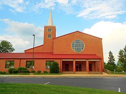
 Colonial Park United Church of Christ | |
 Location in Dauphin County and state of Pennsylvania. | |
| Country | United States |
| State | Pennsylvania |
| County | Dauphin |
| Settled | 1717 |
| Incorporated | 1729 |
| Area | |
• Total | 28.17 sq mi (72.96 km2) |
| • Land | 28.17 sq mi (72.96 km2) |
| • Water | 0.00 sq mi (0.00 km2) |
| Population | |
• Total | 53,501 |
• Estimate (2022)[3] | 54,089 |
| • Density | 1,900/sq mi (730/km2) |
| Time zone | UTC-5 (Eastern (EST)) |
| • Summer (DST) | UTC-4 (EDT) |
| Area code(s) | 717 and 223 |
| FIPS code | 42-043-45056 |
| Website | lowerpaxton-pa |
Lower Paxton is a township in Dauphin County, Pennsylvania, United States. The population was 53,501 at the 2020 census.[2] It is the most populous municipality in Dauphin County and the 17th-most populated municipality in the state.[4]
Lower Paxton Township is located 76.6 miles (123.3 km) miles southwest of Allentown, 9.4 miles (15.1 km) northeast of Harrisburg, and 107.3 miles (172.7 km) northwest of Philadelphia.
The township was incorporated in 1767 from Paxton Township.
- ^ "2016 U.S. Gazetteer Files". United States Census Bureau. Retrieved August 13, 2017.
- ^ a b Cite error: The named reference
QF2020was invoked but never defined (see the help page). - ^ "City and Town Population Totals: 2020-2021". Census.gov. US Census Bureau. Retrieved July 13, 2022.
- ^ "Geographic Identifiers: 2010 Demographic Profile Data (G001): All County Subdivisions within Dauphin County, Pennsylvania". U.S. Census Bureau, American Factfinder. Archived from the original on February 13, 2020. Retrieved December 17, 2015.

