Back Maanwentelprogram Afrikaans برنامج المتتبع القمري Arabic Лунар Орбитър Bulgarian Programa Lunar Orbiter Catalan Program Lunar Orbiter Czech Lunar Orbiter-programmet Danish Lunar Orbiter German Programa Lunar Orbiter Spanish Lunar Orbiter programa Basque برنامه مدارگرد ماه Persian

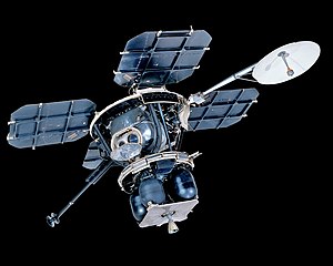
The Lunar Orbiter program was a series of five uncrewed lunar orbiter missions launched by the United States in 1966 and 1967. Intended to help select Apollo landing sites by mapping the Moon's surface,[1] they provided the first photographs from lunar orbit and photographed both the Moon and Earth.
All five missions were successful, and 99 percent of the lunar surface was mapped from photographs taken with a resolution of 60 meters (200 ft) or better. The first three missions were dedicated to imaging 20 potential crewed lunar landing sites, selected based on Earth-based observations. These were flown at low-inclination orbits. The fourth and fifth missions were devoted to broader scientific objectives and were flown in high-altitude polar orbits. Lunar Orbiter 4 photographed the entire nearside and nine percent of the far side, and Lunar Orbiter 5 completed the far side coverage and acquired medium (20 m or 66 ft) and high (2 m or 6 ft 7 in) resolution images of 36 preselected areas. All of the Lunar Orbiter spacecraft were launched by Atlas-Agena-D launch vehicles.
The Lunar Orbiters had an imaging system which consisted of a dual-lens camera, a film processing unit, a readout scanner, and a film handling apparatus. Both lenses, a 610 mm (24 in) narrow angle high resolution (HR) lens and an 80 mm (3.1 in) wide angle medium resolution (MR) lens, placed their frame exposures on a single roll of 70 mm film. The axes of the two cameras were coincident so the area imaged in the HR frames were centered within the MR frame areas. The film was moved during exposure to compensate for the spacecraft velocity, which was estimated by an electro-optical sensor. The film was then processed, scanned, and the images transmitted back to Earth.
During the Lunar Orbiter missions, the first pictures of Earth as a whole were taken, beginning with Earth-rise over the lunar surface by Lunar Orbiter 1 in August, 1966. The first full picture of the whole Earth was taken by Lunar Orbiter 5 on 8 August 1967.[2] A second photo of the whole Earth was taken by Lunar Orbiter 5 on 10 November 1967.
- ^ Bowker, David E. and J. Kenrick Hughes, Lunar Orbiter Photographic Atlas of the Moon [1], NASA SP-206 (1971).
- ^ "Whole Earth". Lunar Orbiter V. NASA. August 8, 1967. p. 352. Retrieved 2008-12-24.
Clearly visible on the left side of the globe is the eastern half of Africa and the entire Arabian Peninsula.