Back Mallacoota (lungsod sa Ostralya) CEB Mallacoota German مالاکوتا، ویکتوریا Persian Mallacoota French Mallacoota (Victoria) NB Mallacoota Polish Mallacoota, Victoria SIMPLE Mallacoota (ort i Australien) Swedish
| Mallacoota Victoria | |||||||||
|---|---|---|---|---|---|---|---|---|---|
 Mallacoota | |||||||||
| Coordinates | 37°33′0″S 149°45′0″E / 37.55000°S 149.75000°E | ||||||||
| Population | 1,183 (2021 census)[1] | ||||||||
| Postcode(s) | 3892 | ||||||||
| Elevation | 22 m (72 ft) | ||||||||
| Location | |||||||||
| LGA(s) | Shire of East Gippsland | ||||||||
| State electorate(s) | Gippsland East | ||||||||
| Federal division(s) | Gippsland | ||||||||
| |||||||||


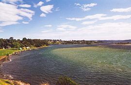
Mallacoota is a town in the East Gippsland region in the state of Victoria, Australia. At the 2021 census, Mallacoota had a population of 1,183. It is the last official township on Victoria's east coast before the border with New South Wales. Mallacoota has a regional airport (Mallacoota Airport) YMCO (XMC) consisting of a gravel runway for light planes and an asphalt runway for commercial planes flying from Melbourne.[2]
It is a popular holiday spot for boating, fishing, walking the wilderness coast, swimming, birdwatching, and surfing. The Mallacoota Arts Council runs events throughout each year. Mallacoota Inlet is one of the main villages along the wilderness coastal walk from New South Wales to Victoria, and Gipsy Point is located at the head of the inlet.
- ^ Australian Bureau of Statistics (28 June 2022). "Mallacoota". 2021 Census QuickStats. Retrieved 1 April 2023.
- ^ YMCO – Mallacoota (PDF). AIP En Route Supplement from Airservices Australia, effective 28 November 2024, Aeronautical Chart
