Back Mananthavady CEB मानंतवाड़ी Hindi Mananthavady Italian മാനന്തവാടി Malayalam Mananthavady Swedish மானந்தவாடி Tamil ماننتاواڑی Urdu
Mananthavady | |
|---|---|
Town | |
 | |
| Coordinates: 11°48′N 76°0′E / 11.800°N 76.000°E | |
| Country | |
| State | Kerala |
| District | Wayanad |
| Government | |
| • Body | Municipality |
| • Member of Parliament | Priyanka Gandhi (Indian National Congress) |
| Area | |
• Total | 80.1 km2 (30.9 sq mi) |
| Elevation | 760 m (2,490 ft) |
| Population (2011) | |
• Total | 47,974 |
| • Density | 600/km2 (1,600/sq mi) |
| Languages | |
| • Official | Malayalam, English |
| Time zone | UTC+5:30 (IST) |
| PIN | 670645 Mananthavady town |
| Telephone code | 04935 |
| ISO 3166 code | IN-KL |
| Vehicle registration | KL-72 |
| Sex ratio | 983 ♂/♀ |
| Literacy | 85.77% |
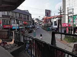
Mananthavady is a Grade 3 municipality, taluk and town in the Wayanad district of Kerala, India. The municipal boundaries are defined by Tirunelli Panchayat to the north, Kabani River to the east and south, and Thavinhal Panchayat to the west.[1] Mananthavady is the third largest town in Wayanad District, following Kalpetta and Sulthan Bathery. It is situated 35 km northeast of the district headquarters, Kalpetta, 80 km east of Thalassery, and 110 km northeast of Kozhikode.[2]
- ^ "St. Thomas Orthodox Church - Mananthavady". directory.mosc.in. MOSC Publications. Retrieved 17 June 2024.
- ^ Kallivalli. "Jeevan's KALLI VALLI : My town Mananthavady". Jeevan's KALLI VALLI. Retrieved 27 July 2024.

