Back Manitoulin District BAR Manitoulin District CEB Manitoulin District German بخش منیتولین Persian District de Manitoulin French Distretto di Manitoulin Italian マニトゥーリン地区 Japanese Dystrykt Manitoulin Polish ضلع مانیٹولن PNB Distrito de Manitoulin Portuguese
Manitoulin District | |
|---|---|
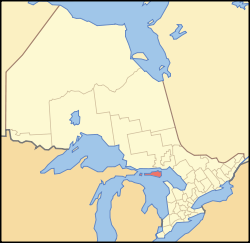
 Location of Manitoulin District within Ontario | |
| Coordinates: 45°46′N 82°12′W / 45.767°N 82.200°W | |
| Country | Canada |
| Province | Ontario |
| Region | Northeastern Ontario |
| Created | 1888 |
| Government | |
| • MP | Carol Hughes |
| • MPP | Michael Mantha |
| Area | |
| • Land | 3,073.54 km2 (1,186.70 sq mi) |
| Population (2021)[1] | |
• Total | 13,935 |
| • Density | 4.5/km2 (12/sq mi) |
| Time zone | UTC-5 (Eastern (EST)) |
| • Summer (DST) | UTC-4 (EDT) |
| Postal code span | P0P |
| Area code | 705 |
| Seat | Gore Bay |
Manitoulin District is a district in Northeastern Ontario within the Canadian province of Ontario. It was created in 1888 from part of the Algoma District. The district seat is in Gore Bay.
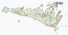
It comprises Manitoulin Island primarily, as well as a number of smaller islands surrounding it, such as Barrie, Cockburn, and Great La Cloche islands. Previously it included the municipality of Killarney on the mainland, until this was transferred to Sudbury District in the late 1990s. Subsequently, more mainland portions were added to Killarney and these, together with Unorganized Mainland Manitoulin District, were also transferred to Sudbury District in 2006, about 1,600 square kilometres (600 sq mi) in all.[2]
- ^ a b "Manitoulin, District (DIS) Census Profile, 2021 Census of Population". www12.statcan.gc.ca. Government of Canada - Statistics Canada. Retrieved 10 December 2024.
- ^ "Annual changes to census subdivision codes, names and types, between 2006 and 2011, by province and territory, and by year". Standard Geographical Classification (SGC) 2011. Statistics Canada. Retrieved 2012-02-22.
