Back মঞ্জেশ্বরম Bengali/Bangla মঞ্জেশ্বর BPY Manjeshwara CEB Manjeshwar Spanish मंजेश्वर Hindi Manjeshwar Italian ಮಂಜೇಶ್ವರ Kannada Manjeshwar Malagasy മഞ്ചേശ്വരം Malayalam Manjeshwar Malay
This article has multiple issues. Please help improve it or discuss these issues on the talk page. (Learn how and when to remove these messages)
|
Manjeshwar | |
|---|---|
Town | |
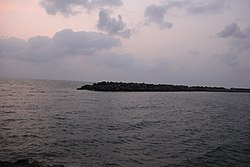
 Manjeshwar harbour | |
| Coordinates: 12°43′27″N 74°52′27″E / 12.7243°N 74.8743°E | |
| Country | |
| State | Kerala |
| District | Kasaragod |
| Taluk | Manjeshwaram |
| Named for | Manjula Kshetra |
| Government | |
| • Body | Grama Panchayat |
| Area | |
• Total | 28.38 km2 (10.96 sq mi) |
| Population (2011)[1] | |
• Total | 41,515 |
| • Density | 1,500/km2 (3,800/sq mi) |
| Languages | |
| • Official | Malayalam, English and Kannada[2][3] |
| Time zone | UTC+5:30 (IST) |
| PIN | 671323 |
| Telephone code | 4998 |
| Vehicle registration | KL-14 |
Manjeshwar is a town and a minor port in Kasaragod district at the northern tip of Kerala. It is situated at a distance of 584 kilometres (360 mi) from the state capital Thiruvananthapuram, 695 kilometres (430 mi) from Kanyakumari, 28 kilometres (20 mi) north of district HQ Kasarakod and 30 kilometres (20 mi) south of Mangalore city in neighboring Karnataka. It is a coastal town in Kasaragod district. Thalappady is the northern border of Kerala situated near to Manjeshwaram town.
- ^ https://censusindia.gov.in › 3...PDF Web results Kasaragod - DISTRICT CENSUS HANDBOOK
- ^ "Kasargod: Success for Kannadigas - Manjeshwar gets linguistic minority status". www.daijiworld.com. Retrieved 18 October 2024.
- ^ "The Kerala Official Language (Legislation) Act, 1969" (PDF). Archived from the original on 11 September 2014.

