Back مارهانيتس Arabic مارهانتس AZB Марганэць Byelorussian Марганец (горад) BE-X-OLD Марганец Bulgarian Màrhanets Catalan Marhanets' CEB Marganets CRH Marhanec Czech Marhanets Danish
Marhanets
Марганець | |
|---|---|
 Palace of Culture | |
| Coordinates: 47°38′41″N 34°36′15″E / 47.64472°N 34.60417°E | |
| Country | |
| Oblast | Dnipropetrovsk Oblast |
| Raion | Nikopol Raion |
| Hromada | Marhanets urban hromada |
| Founded | 1938 |
| Area | |
• Total | 37 km2 (14 sq mi) |
| Elevation | 30 m (100 ft) |
| Population (2022) | |
• Total | 44,980 |
| • Density | 1,200/km2 (3,100/sq mi) |
| Time zone | UTC+2 (EET) |
| • Summer (DST) | UTC+3 (EEST) |
| Area code | +380-5665 |
| Website | http://marganets-rada.dp.ua |
 | |
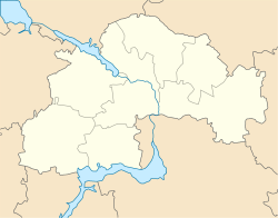
Marhanets (lit. 'Manganese', Ukrainian: Марганець, Russian: Марганец, romanized: Marganets) is a city in Nikopol Raion, Dnipropetrovsk Oblast, Ukraine. The city used to be located on the right bank of the Kakhovka Reservoir before the Reservoir’s destruction during the Russian invasion of Ukraine on the Dnieper River where the river meets one of its tributaries, the Tomakivka. Marhanets hosts the administration of Marhanets urban hromada, one of the hromadas of Ukraine.[1] Its population is approximately 44,980 (2022 estimate).[2]
It was established in 1938 in place of the village of Horodyshche, which contained a manganese mine (mining town) and was called Komintern from 1926 to 1938.
- ^ "Марганецкая городская громада" (in Russian). Портал об'єднаних громад України.
- ^ Чисельність наявного населення України на 1 січня 2022 [Number of Present Population of Ukraine, as of January 1, 2022] (PDF) (in Ukrainian and English). Kyiv: State Statistics Service of Ukraine. Archived (PDF) from the original on 4 July 2022.


