Back Maria de la Salut AN ماريا دي لا سالود Arabic ماريا دى لا سالود ARZ Maria de la Salut Catalan Мария-де-ла-Салуд CE Maria de la Salut (munisipyo) CEB María de la Salud Danish Maria de la Salut German Maria de la Salut Esperanto María de la Salud Spanish
Maria de la Salut | |
|---|---|
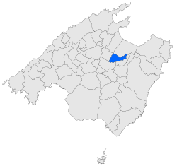
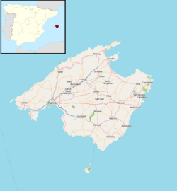
 Location within Mallorca | |
| Coordinates: 39°39′52″N 3°04′29″E / 39.66444°N 3.07472°E | |
| Country | |
| Autonomous community | |
| Province | Balearic Islands |
| Comarca | Pla de Mallorca |
| Area | |
• Total | 30.49 km2 (11.77 sq mi) |
| Elevation | 123 m (404 ft) |
| Population (2018)[1] | |
• Total | 2,143 |
| • Density | 70/km2 (180/sq mi) |
| [2] | |
| Time zone | UTC+1 (CET) |
| • Summer (DST) | UTC+2 (CEST) |
Maria de la Salut (Catalan pronunciation: [məˈɾi.ə ðə lə səˈlut]) is a small town and municipality located in the center of the island in the district of es pla on Majorca and in the northeast of the capital, one of the Balearic Islands, Spain. It borders on the municipalities of Llubí, Santa Margalida, Ariany and Sineu.
- ^ Municipal Register of Spain 2018. National Statistics Institute.
- ^ National Institute of Statistics of Spain


