Back ضاحية مارويجيني Arabic Distrikt Marowijne CEB Marowijne Danish Marowijne German Marowijne Esperanto Distrito de Marowijne Spanish ناحیه مارووینه Persian Marowijne Finnish Marowijne French Marowijne (Distrikt) FRR
Marowijne | |
|---|---|
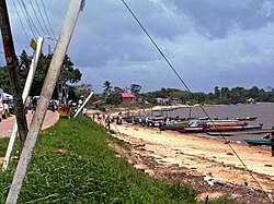
 Boats on the beach in Albina | |
 Map of Suriname showing Marowijne district | |
| Coordinates: 5°46′N 56°19′W / 5.767°N 56.317°W | |
| Country | Suriname |
| Capital | Albina |
| Area | |
• Total | 4,627 km2 (1,786 sq mi) |
| Population (2012 census)[1] | |
• Total | 18,294 |
| • Density | 4.0/km2 (10/sq mi) |
| Time zone | UTC-3 |
Marowijne (Dutch pronunciation: [maːroːˈʋɛinə]) is a district of Suriname, located on the north-east coast. Marowijne's capital city is Albina, with other towns including Moengo and Wanhatti. The district borders the Atlantic Ocean to the north, French Guiana to the east, the Surinamese district of Sipaliwini to the south, and the Surinamese districts of Commewijne and Para to the west.[2]
Marowijne's population is 18,294 and the district has an area of 4,627 km2.[1]
- ^ a b "Resorts in Suriname Census 2012" (PDF). Retrieved 21 May 2020.
- ^ "Distrikt Marowijne". Suriname.nu (in Dutch). Retrieved 21 May 2020.