Masterton | |||||||||||
|---|---|---|---|---|---|---|---|---|---|---|---|
| Metlink regional rail | |||||||||||
 | |||||||||||
| General information | |||||||||||
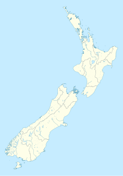
| Location | Perry Street, Masterton, New Zealand | ||||||||||
| Coordinates | 40°56.420′S 175°39.321′E / 40.940333°S 175.655350°E | ||||||||||
| Elevation | 115 metres (377 ft) | ||||||||||
| Owned by | Greater Wellington Regional Council | ||||||||||
| Line(s) | Wairarapa Line | ||||||||||
| Distance | 90.96 kilometres (56.52 mi) from Wellington | ||||||||||
| Platforms | Single side | ||||||||||
| Tracks |
| ||||||||||
| Train operators | Transdev Wellington | ||||||||||
| Construction | |||||||||||
| Structure type | At-grade | ||||||||||
| Parking | Yes | ||||||||||
| Bicycle facilities | Yes | ||||||||||
| Architectural style | Mid-century modern | ||||||||||
| Other information | |||||||||||
| Station code | MAST | ||||||||||
| Fare zone | 14[1] | ||||||||||
| History | |||||||||||
| Opened | 1 November 1880 | ||||||||||
| Rebuilt | 1967 | ||||||||||
| Services | |||||||||||
| |||||||||||
| |||||||||||
| |||||||||||
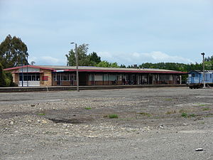
Masterton railway station is a single-platform, urban railway station serving the town of Masterton in New Zealand's Wairarapa district. Located at the end of Perry Street, it is one of three stations in Masterton, the others being Renall Street and Solway. Masterton station is the terminus for Wairarapa Connection passenger services on Metlink's Wairarapa Line from and to Wellington. The average journey time to Wellington is one hour and forty-three minutes.
The station building has a ticket office and café; the yard has working freight-handling facilities, a goods shed, a turntable, and engine/railcar shed.
- ^ Metlink. "Text description of fare zone boundaries". Greater Wellington Regional Council. Archived from the original on 18 December 2007. Retrieved 27 November 2007.


