Back مقاطعة ميرسيد (كاليفورنيا) Arabic ميرسيد (مقاطعه فى كاليفورنيا) ARZ Mersed qraflığı (Kaliforniya) Azerbaijani Merced County, Kalifornien BAR Мерсед (акруга) Byelorussian Мърсед (окръг) Bulgarian মার্সিড কাউন্টি, ক্যালিফোর্নিয়া BPY Мерсед (гуо, Калифорни) CE Merced County CEB Merced County Czech
Merced County, California | |
|---|---|
| County of Merced | |
|
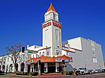
Images, from top down, left to right: The historic Merced Theatre, San Luis Reservoir, UC Merced, The B-29A Super Fortress exhibit at the Castle Air Museum in Atwater | |
 Interactive map of Merced County | |
 Location in the state of California | |
| Coordinates: 37°11′N 120°43′W / 37.19°N 120.71°W | |
| Country | United States |
| State | California |
| Region | San Joaquin Valley |
| Incorporated | April 19, 1855[1] |
| Named for | Merced River, originally El Río de Nuestra Señora de la Merced ("River of Our Lady of Mercy" in Spanish). |
| County seat | Merced |
| Largest city | Merced |
| Government | |
| • Type | Council–CEO |
| • Body | Board of Supervisors |
| • Chair | Lloyd Pareira, Jr |
| • Vice Chair | Scott Silveira |
| • Board of Supervisors[2] | Supervisors
|
| • Chief executive officer | Raul Lomeli Mendez |
| Area | |
• Total | 1,979 sq mi (5,130 km2) |
| • Land | 1,935 sq mi (5,010 km2) |
| • Water | 44 sq mi (110 km2) |
| Highest elevation | 3,801 ft (1,159 m) |
| Population (2020) | |
• Total | 281,202 |
| • Density | 140/sq mi (55/km2) |
| GDP | |
| • Total | $11.560 billion (2022) |
| Time zone | UTC−8 (Pacific Time Zone) |
| • Summer (DST) | UTC−7 (Pacific Daylight Time) |
| ZIP code | 93620, 93635, 93661, 93665, 95301, 95303, 95312, 95315, 95317, 95322, 95324, 95333, 95334, 95388, 95340, 95341, 95343, 95344, 95348, 95365, 95369, 95374[5] |
| Area code | 209 |
| FIPS code | 06-047 |
| GNIS feature ID | 277288 |
| Congressional district | 13th |
| Website | www |
Merced County (/mərˈsɛd/ ⓘ mər-SED) is a county located in the northern San Joaquin Valley section of the Central Valley, in the U.S. state of California.
As of the 2020 census, the population was 281,202.[6] The county seat is Merced.[7] The county is named after the Merced River.
Merced County comprises the Merced, CA Metropolitan Statistical Area, which is included in the Modesto-Merced, CA Combined Statistical Area. It is located north of Fresno County and Fresno, and southeast of Santa Clara County and San Jose.
- ^ "Merced County". Geographic Names Information System. United States Geological Survey, United States Department of the Interior. Retrieved January 31, 2015.
- ^ "Board Members | Merced County, CA - Official Website".
- ^ "Laveaga Peak". Peakbagger.com. Retrieved January 31, 2015.
- ^ "Gross Domestic Product: All Industries in Merced County, CA". Federal Reserve Economic Data. Federal Reserve Bank of St. Louis.
- ^ "Merced County, CA Zip Codes". Zip-Codes.com. Retrieved May 29, 2016.
- ^ "Merced County, California". United States Census Bureau. Retrieved January 30, 2022.
- ^ "Find a County". National Association of Counties. Retrieved June 7, 2011.


