Back Meuse Afrikaans Département Meuse ALS Mosa AN موز (إقليم فرنسي) Arabic Meuse AST Möz (departament) Azerbaijani Département Meuse BAR Мёз (дэпартамент) Byelorussian Мёз (дэпартамэнт) BE-X-OLD Мьоз (департамент) Bulgarian
Meuse | |
|---|---|
 Prefecture building of the Meuse department, in Bar-le-Duc | |
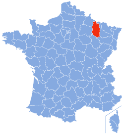
 Location of Meuse in France | |
| Coordinates: _type:adm2nd_scale:1000000_source:frwiki 49°00′N 05°20′E / 49.000°N 5.333°E | |
| Country | France |
| Region | Grand Est |
| Prefecture | Bar-le-Duc |
| Subprefectures | Commercy Verdun |
| Government | |
| • President of the Departmental Council | Jérôme Dumont[1] |
| Area | |
• Total | 6,211 km2 (2,398 sq mi) |
| Population (2022)[2] | |
• Total | 180,745 |
| • Rank | 91st |
| • Density | 29/km2 (75/sq mi) |
| Demonym(s) | Meusiens, Meusiennes |
| Time zone | UTC+1 (CET) |
| • Summer (DST) | UTC+2 (CEST) |
| ISO 3166 code | FR-55 |
| Department number | 55 |
| Largest city | Verdun |
| Arrondissements | 3 |
| Constituency | 2 |
| Cantons | 17 |
| Intercommunality | 15 |
| Communes | 499 |
| ^1 French Land Register data, which exclude estuaries, and lakes, ponds, and glaciers larger than 1 km2 | |
| Part of a series on |
| Lorraine |
|---|
 |
Meuse (French pronunciation: [møz] ⓘ) is a department in northeast France, named after the River Meuse. Meuse is part of the current region of Grand Est and is landlocked and borders by the French departments of Ardennes, Marne, Haute-Marne, Vosges, Meurthe-et-Moselle, and Belgium to the north. Parts of Meuse belong to Parc naturel régional de Lorraine. It had a population of 184,083 in 2019.[3] Front lines in trench warfare during World War I ran varying courses through the department and it hosted an important battle/offensive in 1916 in and around Verdun.
- ^ "Répertoire national des élus: les conseillers départementaux". data.gouv.fr, Plateforme ouverte des données publiques françaises (in French). 4 May 2022.
- ^ "Populations de référence 2022" (in French). The National Institute of Statistics and Economic Studies. 19 December 2024.
- ^ Populations légales 2019: 55 Meuse, INSEE

