Back Mindoro Afrikaans مندورو Arabic Mindoro Azerbaijani Mindoro BCL Міндора Byelorussian Миндоро Bulgarian Mindoro Breton Mindoro Catalan Mindoro CEB Mindoro Czech
This article needs additional citations for verification. (November 2010) |
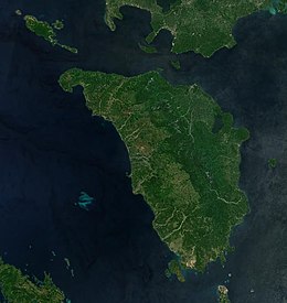
 2020 satellite image of Mindoro | |
 Location of Mindoro in the Philippines | |
| Geography | |
|---|---|
| Location | South East Asia |
| Coordinates | 12°55′49″N 121°5′40″E / 12.93028°N 121.09444°E |
| Archipelago | Philippines |
| Adjacent to | |
| Area | 10,571.8 km2 (4,081.8 sq mi)[1] |
| Area rank | 73rd |
| Coastline | 618.8 km (384.5 mi) |
| Highest elevation | 2,616 m (8583 ft) |
| Highest point | Mount Halcon |
| Administration | |
Philippines | |
| Provinces | |
| Largest settlement | San Jose (pop. 153,267) |
| Demographics | |
| Population | 1,408,454 (2020)[2] |
| Pop. density | 117.2/km2 (303.5/sq mi) |
| Ethnic groups | |
Mindoro is the seventh largest and eighth-most populous island in the Philippines. With a total land area of 10,571 km2 ( 4,082 sq.mi ), it has a population of 1,408,454, as of the 2020 census. It is located off the southwestern coast of Luzon and northeast of Palawan. Mindoro is divided into two provinces: Occidental Mindoro and Oriental Mindoro. Calapan is the only city in the island while San Jose is the largest settlement on the island with a total population of 143,430 inhabitants as of 2015. The southern coast of Mindoro forms the northeastern extremum of the Sulu Sea.[3] Mount Halcon is the highest point on the island, standing at 8,484 feet (2,586 m) above sea level located in Oriental Mindoro. Mount Baco is the island's second highest mountain with an elevation of 8,163 feet (2,488 m), located in the province of Occidental Mindoro.
- ^ "Islands of Philippines". Island Directory. United Nations Environment Programme. Retrieved 22 May 2015.
- ^ "Total Population by Province, City, Municipality and Barangay: as of May 1, 2010" (PDF). 2010 Census of Population and Housing. National Statistics Office. Archived from the original (PDF) on 11 March 2016. Retrieved 22 May 2015.
- ^ C.Michael Hogan. 2011. Sulu Sea