| Mintaro South Australia | |||||||||||||||
|---|---|---|---|---|---|---|---|---|---|---|---|---|---|---|---|
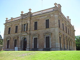
 Martindale Hall | |||||||||||||||
| Coordinates | 33°55′01″S 138°43′15″E / 33.91694°S 138.72083°E | ||||||||||||||
| Population | 218 (SAL 2021)[1] | ||||||||||||||
| Established | 1849 | ||||||||||||||
| Postcode(s) | 5415 | ||||||||||||||
| Location | |||||||||||||||
| LGA(s) | District Council of Clare and Gilbert Valleys | ||||||||||||||
| Region | Mid North | ||||||||||||||
| State electorate(s) | Frome | ||||||||||||||
| Federal division(s) | Grey | ||||||||||||||
| |||||||||||||||
| Footnotes | [2] | ||||||||||||||
Mintaro is a historic town in the eastern Clare Valley, east of the Horrocks Highway, about 126 kilometres (78 miles) north of Adelaide, South Australia. The town lies at the south-eastern corner of the Hundred of Clare, within the Clare Valley wine region. Established in 1849, Mintaro is situated on land which was bought originally by Joseph and Henry Gilbert, which they sub-divided into 80 allotments.
Mintaro was originally intended as a stopping and resting place for the bullock teams carting copper ore from the Burra mine to Port Wakefield. By 1876 the population was recorded as 400. Mintaro continued to develop as a rural service centre during the 1870s and early 1880s, when pastoral and agricultural activities boomed in the state's mid north. After 1930, there was a general decline in rural populations and little development took place within the town for several decades.
The Mintaro district includes prominent Martindale Hall and Kadlunga, two large pastoral properties. Known for its high quality, Mintaro slate is produced from what is believed to be the oldest continuing operating quarry in Australia. Although Mintaro is primarily an agricultural community, tourism plays an increasingly important role. Due to its historical and cultural significance, the entire town of Mintaro was declared a State Heritage Area for South Australia in 1984. In recent years, Mintaro has become a popular tourist destination and had increased building restoration and residential development.
- ^ Australian Bureau of Statistics (28 June 2022). "Mintaro (suburb and locality)". Australian Census 2021 QuickStats. Retrieved 28 June 2022.
- ^ "Placename Details: Mintaro". Property Location Browser Report. Government of South Australia. 4 March 2010. SA0002678. Archived from the original on 12 October 2016. Retrieved 10 January 2018.

