| Minton | |
|---|---|
 Minton, Shropshire | |
Location within Shropshire | |
| OS grid reference | SO429907 |
| Civil parish | |
| Unitary authority | |
| Ceremonial county | |
| Region | |
| Country | England |
| Sovereign state | United Kingdom |
| Post town | CHURCH STRETTON |
| Postcode district | SY6 |
| Dialling code | 01694 |
| Police | West Mercia |
| Fire | Shropshire |
| Ambulance | West Midlands |
| UK Parliament | |
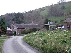
Minton is a hamlet in Shropshire, England.
It is located in the parish of Church Stretton,[1] 2+1⁄2 miles (4.0 km) southwest of the market town of Church Stretton. A historic settlement, it is situated on a foothill of the Long Mynd at around 240 m (790 ft) above sea level. As of 2010, there are around 12 dwellings in the hamlet.
Three lanes lead out from the hamlet: one to the A49 road, one mile southeast at Marshbrook; another lane leads to the hamlet of Hamperley, which is also in Church Stretton parish; and Little Stretton is one mile to the northeast.
- ^ "Church Stretton Town Council". Church Stretton Area. Archived from the original on 19 September 2010. Retrieved 10 April 2010.

