Back MODIS Catalan Moderate-resolution Imaging Spectroradiometer German Espectrorradiómetro de imágenes de media resolución Spanish MODIS Estonian پرتوسنج طیفی تصویربرداری با توان تفکیک متوسط Persian Moderate-Resolution Imaging Spectroradiometer French Moderate-Resolution Imaging Spectroradiometer ID Moderate-Resolution Imaging Spectroradiometer Italian MODIS Japanese MODIS Dutch


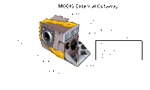
The Moderate Resolution Imaging Spectroradiometer (MODIS) is a satellite-based sensor used for earth and climate measurements. There are two MODIS sensors in Earth orbit: one on board the Terra (EOS AM) satellite, launched by NASA in 1999; and one on board the Aqua (EOS PM) satellite, launched in 2002. MODIS has now been replaced by the VIIRS,[citation needed] which first launched in 2011 aboard the Suomi NPP satellite.
The MODIS instruments were built by Santa Barbara Remote Sensing.[1] They capture data in 36 spectral bands ranging in wavelength from 0.4 μm to 14.4 μm and at varying spatial resolutions (2 bands at 250 m, 5 bands at 500 m and 29 bands at 1 km). Together the instruments image the entire Earth every 1 to 2 days. They are designed to provide measurements in large-scale global dynamics including changes in Earth's cloud cover, radiation budget and processes occurring in the oceans, on land, and in the lower atmosphere.
Support and calibration is provided by the MODIS characterization support team (MCST).[2]
- ^ "MODIS Components". Retrieved 11 August 2015.
- ^ "MODIS Characterization Support Team". Retrieved 18 July 2015.