Back مانفورت هایتس ایست، اوهایو AZB Monfort Heights East Catalan Monfort Heights East CEB Monfort Heights East (Ohio) Basque مانفورت هایتس ایست، اوهایو Persian Monfort Heights East Dutch Monfort Heights East Portuguese Monfort Heights East (Ohio) ZH-MIN-NAN
Monfort Heights East, Ohio | |
|---|---|
Former CDP | |
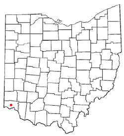
 Location of Monfort Heights East, Ohio | |
| Coordinates: 39°11′19″N 84°34′59″W / 39.18861°N 84.58306°W | |
| Country | United States |
| State | Ohio |
| County | Hamilton |
| Area | |
• Total | 1.4 sq mi (3.7 km2) |
| • Land | 1.4 sq mi (3.7 km2) |
| • Water | 0.0 sq mi (0.0 km2) |
| Population (2000) | |
• Total | 3,880 |
| • Density | 2,696.2/sq mi (1,041.0/km2) |
| Time zone | UTC-5 (Eastern (EST)) |
| • Summer (DST) | UTC-4 (EDT) |
| FIPS code | 39-51215[1] |
Monfort Heights East was a census-designated place (CDP) in Green Township, Hamilton County, Ohio, United States. The population was 3,880 at the 2000 census. For the 2010 census the area was merged into the new Monfort Heights CDP.
- ^ "U.S. Census website". United States Census Bureau. Retrieved 2008-01-31.
- ^ "US Board on Geographic Names". United States Geological Survey. 2007-10-25. Retrieved 2008-01-31.