Back مقاطعة مونرو (نيويورك) Arabic مونرو بؤلگهسی، نیویورک AZB Monroe County, New York BAR Монро (окръг, Ню Йорк) Bulgarian মনরৌ কাউন্টি, নিউ ইয়র্ক BPY Monroe Gông (New York) CDO Монро (гуо, Нью-Йорк) CE Monroe County (kondado sa Tinipong Bansa, New York) CEB Monroe County (New York) Czech Monroe County, Efrog Newydd Welsh
Monroe County | |
|---|---|
 Monroe County Gordon A. Howe Office Building on Main and Fitzhugh street in Rochester. | |
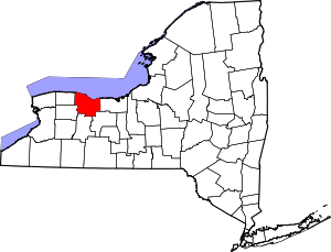
 Location within the U.S. state of New York | |
 New York's location within the U.S. | |
| Coordinates: 43°18′N 77°41′W / 43.3°N 77.69°W | |
| Country | |
| State | |
| Founded | February 23, 1821 |
| Named for | James Monroe |
| Seat | Rochester |
| Largest city | Rochester |
| Government | |
| • County Executive | Adam Bello (D) |
| Area | |
• Total | 1,367 sq mi (3,540 km2) |
| • Land | 657 sq mi (1,700 km2) |
| • Water | 710 sq mi (1,800 km2) 52% |
| Population (2020) | |
• Total | 759,443 |
• Estimate (2022) | 752,035 |
| • Density | 560/sq mi (210/km2) |
| Time zone | UTC−5 (Eastern) |
| • Summer (DST) | UTC−4 (EDT) |
| Congressional district | 25th |
| Website | www |
Monroe County is a county in the U.S. state of New York, located along Lake Ontario's southern shore. As of 2022, the population was 752,035, according to Census Bureau estimates.[1] Its county seat and largest city is Rochester.[2] The county is named after James Monroe, the fifth president of the United States.[3] Monroe County is part of the Rochester, NY Metropolitan Statistical Area. The county is part of the Finger Lakes region of the state.
- ^ "QuickFacts - Monroe County, New York". United States Census Bureau. Retrieved August 13, 2021.
- ^ "Find a County". National Association of Counties. Retrieved June 7, 2011.
- ^ Gannett, Henry (1905). The Origin of Certain Place Names in the United States. U.S. Government Printing Office. p. 212.

