Back مونتيغو Arabic مونتيجو ARZ مونتاق، میشیقان AZB Монтахью (Мичиган) CE Montague (lungsod sa Tinipong Bansa, Michigan) CEB Montague, Michigan Welsh Montague (Míchigan) Spanish Montague (Michigan) Basque مونتاگ، میشیگان Persian Montague (Michigan) French
Montague, Michigan | |
|---|---|
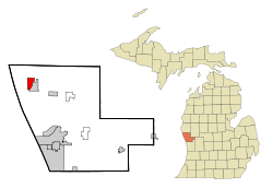
 Location within Muskegon County and the state of Michigan | |
| Coordinates: 43°25′N 86°21′W / 43.417°N 86.350°W | |
| Country | United States |
| State | Michigan |
| County | Muskegon |
| Government | |
| • Mayor | Tom Lohman |
| Area | |
• Total | 3.14 sq mi (8.14 km2) |
| • Land | 2.63 sq mi (6.81 km2) |
| • Water | 0.52 sq mi (1.33 km2) |
| Elevation | 636 ft (194 m) |
| Population | |
• Total | 2,417 |
| • Density | 920.06/sq mi (355.17/km2) |
| Time zone | UTC-5 (EST) |
| • Summer (DST) | UTC-4 (EDT) |
| ZIP code | 49437 |
| Area code | 231 |
| FIPS code | 26-55100[3] |
| GNIS feature ID | 1620880[4] |
| Website | cityofmontague |
Montague is a city in Muskegon County, Michigan, United States. The population was 2,417 at the 2020 census.[2] The city is politically independent from Montague Township, which borders it on three sides.
- ^ "2023 U.S. Gazetteer Files: Michigan". United States Census Bureau. Retrieved December 13, 2023.
- ^ a b "P1. Race – Montague city, Michigan: 2020 DEC Redistricting Data (PL 94-171)". U.S. Census Bureau. Retrieved December 13, 2023.
- ^ "U.S. Census website". United States Census Bureau. Retrieved January 31, 2008.
- ^ U.S. Geological Survey Geographic Names Information System: Montague, Michigan