Back Montferland Afrikaans مونتفيرلاند Arabic Montferland Catalan Gemeente Montferland CEB Montferland German Montferland Esperanto Montferland (municipio) Spanish Montferland Basque مونتفرلاند Persian Montferland Finnish
Montferland | |
|---|---|
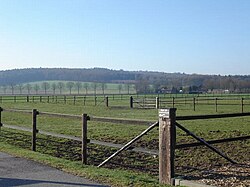
 Looking towards the Montferland hills | |
 Location in Gelderland | |
| Coordinates: 51°56′N 6°8′E / 51.933°N 6.133°E | |
| Country | Netherlands |
| Province | Gelderland |
| Established | 1 January 2005[1] |
| Government | |
| • Body | Municipal council |
| • Mayor | Harry de Vries (acting) (CDA) |
| Area | |
• Total | 106.64 km2 (41.17 sq mi) |
| • Land | 105.70 km2 (40.81 sq mi) |
| • Water | 0.94 km2 (0.36 sq mi) |
| Elevation | 13 m (43 ft) |
| Highest elevation | 93 m (305 ft) |
| Population (January 2021)[6] | |
• Total | 36,031 |
| • Density | 341/km2 (880/sq mi) |
| Time zone | UTC+1 (CET) |
| • Summer (DST) | UTC+2 (CEST) |
| Postcode | 6940–6942, 7035–7048 |
| Area code | 0314, 0316 |
| Website | www |

Montferland (Dutch pronunciation: [ˈmɔntfərlɑnt] ⓘ) is a municipality in the Dutch province of Gelderland. It was created on 1 January 2005 from the amalgamation of the former municipalities of Bergh and Didam.
- ^ "Gemeentelijke indeling op 1 januari 2005" [Municipal divisions on 1 January 2005]. cbs.nl (in Dutch). CBS. Retrieved 10 July 2014.
- ^ "Samenstelling college" [Members of the board] (in Dutch). Gemeente Montferland. Retrieved 10 July 2014.
- ^ "Kerncijfers wijken en buurten 2020" [Key figures for neighbourhoods 2020]. StatLine (in Dutch). CBS. 24 July 2020. Retrieved 19 September 2020.
- ^ "Postcodetool for 6942GK". Actueel Hoogtebestand Nederland (in Dutch). Het Waterschapshuis. Retrieved 10 July 2014.
- ^ "Bergherbos in Montferland". Brockhausen. Retrieved 27 August 2020.
- ^ "Bevolkingsontwikkeling; regio per maand" [Population growth; regions per month]. CBS Statline (in Dutch). CBS. 1 January 2021. Retrieved 2 January 2022.
