| Moose River | |
|---|---|
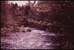
 North Branch Moose River in 1973 | |
 | |
| Location | |
| Country | United States |
| State | New York |
| Physical characteristics | |
| Source | Middle Branch Moose River, South Branch Moose River |
| • location | McKeever, New York |
| Mouth | Black River |
• location | Lyons Falls, New York |
• coordinates | 43°36′47″N 75°20′12″W / 43.61306°N 75.33667°W |
• elevation | 849 ft (259 m) |
| Basin size | 429 sq mi (1,110 km2) |
The Moose River is a mountain waterway in Upstate New York which consists of three branches: the North Branch, the Middle Branch and the South Branch. The outlet of Big Moose Lake forms the North Branch in northern Herkimer County. The Middle Branch originates at the Fulton Chain Lakes in Old Forge. And the Southern Branch has its headwaters in Little Moose Lake in Hamilton County. The North and Middle branches merge in old Forge, New York, then flow a few miles before merging with the South branch, and then becomes just Moose River. It flows generally westwardly through Herkimer County into Lewis County, reaching its confluence with the Black River in Lyons Falls.
