Back Morecambe Bay CEB Bae Morecambe Welsh Morecambe Bay German Bahía de Morecambe Spanish Morecambenlahti Finnish Baie de Morecambe French Bá Morecambe Irish Morkamas līcis Latvian/Lettish Morecambe Bay Dutch Morecambe Bay NN
| Designations | |
|---|---|
| Official name | Morecambe Bay |
| Designated | 4 October 1996 |
| Reference no. | 863[1] |
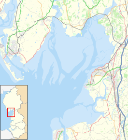
Morecambe Bay is an estuary in north-west England, just to the south of the Lake District National Park. It is the largest expanse of intertidal mudflats and sand in the United Kingdom, covering a total area of 120 sq mi (310 km2). In 1974, the second largest gas field in the UK was discovered 25 mi (40 km) west of Blackpool, with original reserves of over 7 trillion cubic feet (tcf) (200 billion cubic metres). At its peak, 15% of Britain's gas supply came from the bay but production is now in decline. Morecambe Bay is also an important wildlife site, with abundant birdlife and varied marine habitats.
- ^ "Morecambe Bay". Ramsar Sites Information Service. Retrieved 25 April 2018.


