Back Mount Binuluan (bukid sa Pilipinas) CEB Ambalatungan Czech Ambalatungan German Ambalatungan Esperanto Monte Binuluan Spanish Bantay Binuluan ILO Mount Binuluan LLD Mount Ambalatungan Dutch Mount Binuluan NB Амбалатунган Russian
| Mount Binuluan | |
|---|---|
| |
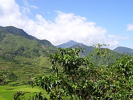
 Mount Binuluan as viewed from the village of Bangtitan in Upper Uma, Lubuagan | |
| Highest point | |
| Elevation | 2,329 m (7,641 ft) |
| Prominence | 431 m (1,414 ft) |
| Listing | Active volcanoes in the Philippines |
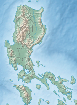
| Coordinates | 17°18′22.4″N 121°5′38.6″E / 17.306222°N 121.094056°E |
| Geography | |
| Country | Philippines |
| Region | Cordillera Administrative Region |
| Province | Kalinga |
| City/municipality | |
| Parent range | Cordillera Central |
| Topo map | 7277-IV |
| Geology | |
| Mountain type | Stratovolcano |
| Volcanic arc | Luzon Volcanic Arc |
| Last eruption | 1952 (?), 1986 (?) |
| Climbing | |
| First ascent | Unknown |
| Easiest route | Unknown |
Mount Binuluan (also known as Ambalatungan) is a remote volcano in the Kalinga province of the Cordillera Administrative Region of the Philippines. The 2,329-metre-high (7,641 ft) mountain is part of the Cordillera Central mountain range on Luzon island, the largest island in the country. Binuluan exhibits active volcanism through numerous fumarole fields, solfataras and hot springs on its slope. There were reports of possible eruptions in 1952 and 1986 (or 1987), but they are unverified.

