Back Moermansk Afrikaans مورمانسك Arabic Múrmansk AST Murmansk Azerbaijani مورمانسک AZB Мурманск Bashkir Murmansk BAN Мурманск Byelorussian Мурманск BE-X-OLD Мурманск Bulgarian
Murmansk
Мурманск | |
|---|---|
| Other transcription(s) | |
| • Kildin Sami | Мурман ланнҍ |
| • Northern Sami | Murmánska |
| • Skolt Sami | Muurman[2] |
 Murmansk skyline | |
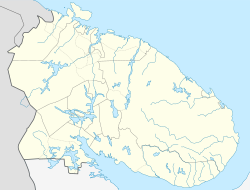
| Coordinates: 68°58′14″N 33°04′30″E / 68.97056°N 33.07500°E | |
| Country | Russia |
| Federal subject | Murmansk Oblast[1] |
| Official foundation date (see text) | 4 October 1916[3] |
| City status since | 19 July 1916[3] |
| Government | |
| • Body | Council of Deputies |
| • Head/Mayor | Dmitry Filippov (Head) Evgeniy Nikora (Mayor) |
| Area | |
• Total | 168.14 km2 (64.92 sq mi) |
| Elevation | 50 m (160 ft) |
| Population | |
| 270,384 | |
| • Subordinated to | City of Murmansk[1] |
| • Capital of | Murmansk Oblast,[1] City of Murmansk[1] |
| • Urban okrug | Murmansk Urban Okrug[6] |
| • Capital of | Murmansk Urban Okrug[6] |
| Time zone | UTC+3 (MSK |
| Postal code(s)[8] | 183000–183099 |
| Dialing code(s) | +7 8152 |
| OKTMO ID | 47701000001 |
| City Day | 4 October[9] |
| Website | citymurmansk |
Murmansk (Russian: Мурманск) is a port city and the administrative center of Murmansk Oblast in the far northwest part of Russia. It remains the world's largest city north of the Arctic Circle and sits on both slopes and banks of a modest fjord, Kola Bay, an estuarine inlet of the Barents Sea, with its bulk on the east bank of the inlet. The city is a major port of the Arctic Ocean[10] and is about 100 kilometres (62 mi) from the border with Norway, 180 kilometres (110 mi) from the border with Finland and 1,930 kilometres (1,200 mi) from Moscow.
Benefiting from the North Atlantic Current, Murmansk resembles cities of its size across western Russia, with highway and railway access to the rest of Europe, and the northernmost trolleybus system on Earth. Its connectivity contrasts with the isolation of Arctic ports like the Siberian Dikson on the shores of the Kara Sea, and Iqaluit, in the Canadian Arctic. Despite long, snowy winters, Murmansk's climate is moderated by the generally ice-free waters around it.
Although there was a building boom in the early twentieth century's arms races, Murmansk's population has been in decline since the Cold War, from 468,039 (1989 Soviet census);[11] 336,137 (2002 Census);[12] 307,257 (2010 Census);[13] to 270,384 (2021 Census).[14]
- ^ a b c d e Cite error: The named reference
Ref395was invoked but never defined (see the help page). - ^ "Muurman (subst. erisnimi)". Neahttadigisánit. Retrieved October 11, 2023.
- ^ a b Cite error: The named reference
ATSBook24was invoked but never defined (see the help page). - ^ Russian Federal State Statistics Service. Всероссийская перепись населения 2020 года. Том 1 [2020 All-Russian Population Census, vol. 1] (XLS) (in Russian). Federal State Statistics Service.
- ^ "Численность населения Российской Федерации по муниципальным образованиям на 1 января 2014 года". Archived from the original on August 10, 2014. Retrieved April 24, 2015.
- ^ a b Cite error: The named reference
Ref811was invoked but never defined (see the help page). - ^ "Об исчислении времени". Официальный интернет-портал правовой информации (in Russian). June 3, 2011. Retrieved January 19, 2019.
- ^ "Main Murmansk post office". Archived from the original on February 26, 2012. Retrieved July 18, 2010.
- ^ Stepanova, Anna (September 29, 2017). "День города в Мурманске 2017: программа праздника и перекрытия дорог". Komsomolskaya Pravda. Retrieved November 20, 2017.
- ^ "10 Largest Cities Within the Arctic Circle".
- ^ Всесоюзная перепись населения 1989 г. Численность наличного населения союзных и автономных республик, автономных областей и округов, краёв, областей, районов, городских поселений и сёл-райцентров [All Union Population Census of 1989: Present Population of Union and Autonomous Republics, Autonomous Oblasts and Okrugs, Krais, Oblasts, Districts, Urban Settlements, and Villages Serving as District Administrative Centers]. Всесоюзная перепись населения 1989 года [All-Union Population Census of 1989] (in Russian). Институт демографии Национального исследовательского университета: Высшая школа экономики [Institute of Demography at the National Research University: Higher School of Economics]. 1989 – via Demoscope Weekly.
- ^ Federal State Statistics Service (May 21, 2004). Численность населения России, субъектов Российской Федерации в составе федеральных округов, районов, городских поселений, сельских населённых пунктов – районных центров и сельских населённых пунктов с населением 3 тысячи и более человек [Population of Russia, Its Federal Districts, Federal Subjects, Districts, Urban Localities, Rural Localities—Administrative Centers, and Rural Localities with Population of Over 3,000] (XLS). Всероссийская перепись населения 2002 года [All-Russia Population Census of 2002] (in Russian).
- ^ Russian Federal State Statistics Service (2011). Всероссийская перепись населения 2010 года. Том 1 [2010 All-Russian Population Census, vol. 1]. Всероссийская перепись населения 2010 года [2010 All-Russia Population Census] (in Russian). Federal State Statistics Service.
- ^ "Оценка численности постоянного населения по субъектам Российской Федерации". Federal State Statistics Service. Retrieved September 1, 2022.


