Back منطقة ناغبور Arabic ناجبور ARZ नागपुर जिला Bihari নাগপুর জেলা Bengali/Bangla Districte de Nagpur Catalan Nāgpur (subdistrito sa Indiya) CEB Nagpur (Distrikt) German Distrito de Nagpur Spanish Nagpur barrutia Basque بخش ناگپور (هند) Persian
Nagpur district | |
|---|---|
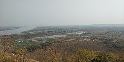
Clockwise from top-left: Deekshabhoomi, Nagardhan Fort, Kalidas Memorial at Ramtek, Rivers at Ambhora, Stone circles of Junapani | |
 Location in Maharashtra | |
| Coordinates (Nagpur): 21°00′N 79°00′E / 21.000°N 79.000°E | |
| Country | |
| State | Maharashtra |
| Division | Nagpur |
| Headquarters | Nagpur |
| Tehsils | 1. Ramtek, 2. Umred, 3. Kalameshwar, 4. Katol, 5. Kamthi, 6. Kuhi, 7. Narkhed, 8. Nagpur, 9. Nagpur (Rural), 10. Parseoni, 11. Bhiwapur, 12. Mouda, 13. Savner, 14. Hingna |
| Government | |
| • Guardian Minister | |
| • Divisional Commissioner |
|
| • District Collector |
|
| • District Council CEO |
|
| • MPs | |
| Area | |
• Total | 9,892 km2 (3,819 sq mi) |
| Population (2011) | |
• Total | 4,653,570 |
| • Density | 470/km2 (1,200/sq mi) |
| • Urban | 64.26% |
| Demographics | |
| • Literacy | 89.5% |
| • Sex ratio | 948 |
| Time zone | UTC+05:30 (IST) |
| Average annual precipitation | 1205 mm |
| Nominal gross domestic product(Nagpur district) | INR 1,81,665 crores (2022-2023) [2] |
| Per capita income(Nagpur district) | INR 2,48,442 (2022-23) [3] |
| Website | nagpur |
Nagpur district (Marathi pronunciation: [naːɡpuːɾ]) is a district in the Vidarbha region of Maharashtra state in central India. The city of Nagpur is the district administrative centre. The district is part of Nagpur Division.
Nagpur district is bounded by Bhandara district on the east, Chandrapur district on the southeast, Wardha district on the southwest, Amravati district on the northwest and Chhindwara district and Seoni district of Madhya Pradesh state on the north.
- ^ "District Nagpur".
- ^ "Economic Survey of Maharashtra 2023-24 (Marathi) : Annexure 3.9" (PDF). Retrieved 8 July 2024.
- ^ Records, Official. "Per capita income Districts of Maharashtra 2019-20". economy Department, Government of Maharashtra, India. Maharashtra Vidhanmanda.


