Back نارانجا، فلوریدا AZB Naranja Catalan Наранья (Флорида) CE Naranja (lungsod) CEB Naranja German Naranja (Florida) Spanish Naranja (Florida) Basque نارانجا، فلوریدا Persian Naranja (Floride) French نارانخا (فلؤريدا) GLK
Naranja, Florida | |
|---|---|
 Location in Miami-Dade County and the state of Florida | |
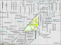
 U.S. Census Bureau map showing CDP boundaries | |
| Coordinates: 25°31′N 80°25′W / 25.517°N 80.417°W | |
| Country | |
| State | |
| County | |
| Area | |
• Total | 1.68 sq mi (4.36 km2) |
| • Land | 1.50 sq mi (3.88 km2) |
| • Water | 0.18 sq mi (0.48 km2) |
| Elevation | 7 ft (2 m) |
| Population | |
• Total | 13,509 |
| • Density | 9,012.01/sq mi (3,480.67/km2) |
| Time zone | UTC-5 (Eastern (EST)) |
| • Summer (DST) | UTC-4 (EDT) |
| ZIP codes | 33032, 33092 |
| Area code(s) | 305, 786, 645 |
| FIPS code | 12-47700[3] |
| GNIS feature ID | 0287532[4] |
Naranja is an unincorporated community and census-designated place (CDP) in Miami-Dade County, Florida, United States. Many orange groves were once located in this area, so the community name came from the Spanish word for orange, naranja, though the pronunciation among the local residents is "Na-Ran-Jah".[5] Naranja was also a stop for the Florida East Coast Railroad that once ran through this area. It is part of the Miami metropolitan area of South Florida. The population was 13,509 at the 2020 census,[2] up from 8,303 in 2010.[6]
- ^ "2022 U.S. Gazetteer Files: Florida". United States Census Bureau. Retrieved January 11, 2023.
- ^ a b "P1. Race – Naranja CDP, Florida: 2020 DEC Redistricting Data (PL 94-171)". U.S. Census Bureau. Retrieved January 11, 2023.
- ^ "U.S. Census website". United States Census Bureau. Retrieved January 31, 2008.
- ^ "US Board on Geographic Names". United States Geological Survey. October 25, 2007. Retrieved January 31, 2008.
- ^ Bach, Trevor (March 25, 2015). "In Naranja, Residents Struggle With Violence and Decrepit Buildings". Miami New Times. Retrieved February 4, 2017.
- ^ "Naranja CDP, Florida". United States Census Bureau. Retrieved March 19, 2016.