Back Nassau Afrikaans ናሶ Amharic Nassau AN Næssā, Bahamas ANG ناساو Arabic ناساو ARY ناساو ARZ Nasáu AST Nassau AVK Nassau Aymara
Nassau | |
|---|---|
|
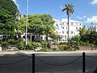
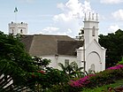
Top: Nassau skyline; Middle: Nassau Terminal Royal Place, Fort Charlotte; Bottom: Parliament Square, Christ Church Cathedral | |
| Nickname: Isle of June[citation needed] | |
Location of Nassau in the Bahamas | |
| Coordinates: 25°02′39″N 77°21′01″W / 25.04417°N 77.35028°W | |
| Country | The Bahamas |
| Island | New Providence |
| Founded and Rebuilt/Renamed | Founded in 1670 as Charles Town, rebuilt as Nassau in 1695[1] |
| Area [2] (for New Providence) | |
• Total | 200 km2 (80 sq mi) |
| Population (2010)[3] (for New Providence) | |
• Total | 246,329 |
| • Density | 1,200/km2 (3,100/sq mi) |
| Time zone | UTC−05:00 (EST) |
| • Summer (DST) | UTC−04:00 (EDT) |
| Area code | 242 |
Nassau (/ˈnæsɔː/ NASS-aw) is the capital and largest city of the Bahamas. It is located on the island of New Providence, which had a population of 246,329 in 2010, or just over 70% of the entire population of the Bahamas.[2] As of April 2023, the preliminary results of the 2022 census of the Bahamas reported a population of 296,522 for New Providence, 74.26% of the country's population.[4] Nassau is commonly defined as a primate city, dwarfing all other towns in the country.[5] It is the centre of commerce, education, law, administration, and media of the country.
Lynden Pindling International Airport, the major airport for the Bahamas, is located about 16 km (9.9 mi) west of the city centre of Nassau, and has daily flights to and from major cities in Canada, the Caribbean, the United Kingdom and the United States. Nassau is the site of the House of Assembly and various judicial departments and was considered historically to be a stronghold of pirates.[6] The city was named in honour of William III of England, Prince of Orange-Nassau.
Nassau's modern growth began in the late eighteenth century, with the influx of thousands of Loyalists and their slaves to the Bahamas following the American War of Independence. Many of them settled in Nassau and eventually came to outnumber the original inhabitants.
As the population of Nassau grew, so did its populated areas. Today, the city dominates the entire island. However, until the post-Second World War era, the outer suburbs scarcely existed. Most of New Providence was uncultivated bush until Loyalists were resettled there following the American Revolutionary War; they established several plantations, such as Clifton and Tusculum. Slaves were imported as labour.
After the British abolished the international slave trade in 1807, they resettled thousands of Africans liberated from slave ships by the Royal Navy on New Providence (at Adelaide Village and Gambier Village), along with other islands such as Grand Bahama, Exuma, Abaco and Inagua. In addition, slaves freed from American ships, such as the slave ship Creole in November 1841, were allowed to settle there. The largest concentration of Africans historically lived in the "Over-the-Hill" suburbs of Grants Town and Bain Town to the south of the city of Nassau, while most of the inhabitants of European descent lived on the island's northern coastal ridges.
- ^ "History of New Providence". Bahamas Guide. Archived from the original on June 10, 2017. Retrieved May 7, 2017.
- ^ a b "New Providence 2010 Census of Population and Housing" (PDF). Government of The Bahamas. August 2012. p. v. Retrieved September 5, 2023.
- ^ 2010 Census of Population and Housing: New Providence (PDF) (Report). Department of Statistics of the Bahamas. August 2012. p. v. Archived (PDF) from the original on December 20, 2016. Retrieved May 18, 2015.
- ^ "Census of Population and Housing 2022 Preliminary Results" (PDF). Commonwealth of The Bahamas. April 2023. p. 3. Retrieved September 7, 2023.
- ^ 2010 Census of Population and Housing: New Providence (PDF) (Report). Department of Statistics of The Bahamas. August 2012. p. 3. Archived (PDF) from the original on December 20, 2016. Retrieved May 18, 2015.
- ^ Klausmann, Ulrike; Meinzerin, Marion; Kuhn, Gabriel (1997). Women Pirates and the Politics of the Jolly Roger (1st ed.). C.P. 1258 Succ. Place du Parc Montreal, Quebec, Canada H2W2R3: Black Rose Books Ltd. p. 192. ISBN 1-55164-058-9.
{{cite book}}: CS1 maint: location (link)


