| The Needles | |
|---|---|
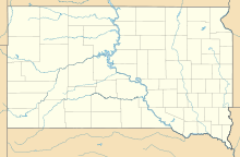
 The Needles, South Dakota, United States | |
| Nearest city | Custer, South Dakota |
| Range | Black Hills |
| Coordinates | 43°50′28″N 103°32′40″W / 43.84111°N 103.54444°W |
| Climbing type | traditional face and crack climbing and bouldering[1] |
| Height | 500 feet (150 m) |
| Pitches | 1 to 4 |
| Grades | 5.0-5.13 |
| Rock type | granite, pegmatite |
| Quantity of rock | years worth ( 2,000 summits) |
| Development | well developed |
| Cliff aspect | mixed mainly traditional climbing |
| Season | spring to fall |
| Ownership | State park |
| Camping | none |
| Stars | |


The Needles of the Black Hills of South Dakota are a region of eroded granite pillars, towers, and spires within Custer State Park. Popular with rock climbers and tourists alike, the Needles are accessed from the Needles Highway, which is a part of Sylvan Lake Road (SD 87/89). The Cathedral Spires and Limber Pine Natural Area, a 637-acre (258 ha) portion of the Needles containing six ridges of pillars as well as a disjunct stand of limber pine, was designated a National Natural Landmark in 1976.[2]
The Needles were the original site proposed for the Mount Rushmore carvings. The location was rejected by the sculptor Gutzon Borglum owing to the poor quality of the granite and the fact that they were too thin to support the sculptures. The Needles attract approximately 300,000 people annually.
- ^ Toula, Tim (1995). Rock 'n' Road (1st ed.). Falcon. ISBN 978-0934641357.
- ^ "National Natural Landmarks - National Natural Landmarks (U.S. National Park Service)". www.nps.gov. Retrieved 2019-03-25.
Year designated: 1976

