Back جزيرة نيشينو Arabic Nishino Shima (pulo sa Hapon, Tōkyō-to) CEB Nišinošima Czech Nishinoshima (Tokio) German Niŝinoŝima Esperanto Nishinoshima Spanish نیشینوشیما Persian Nishino-shima (Ogasawara) French Nishinoshima, Ogasawara Galician Nishinoshima (Ogasawara) ID
Native name: 西之島 | |
|---|---|
 Nishinoshima on 1 December 2018 | |
| Geography | |
| Location | Pacific Ocean |
| Coordinates | 27°14′49″N 140°52′28″E / 27.24694°N 140.87444°E |
| Archipelago | Volcano Islands |
| Total islands | 1 |
| Area | 4.1[1] km2 (1.6 sq mi) |
| Highest elevation | 200 m (700 ft) |
| Administration | |
| Prefecture | Tokyo |
| Subprefecture | Ogasawara Subprefecture |
| Village | Ogasawara |
| Demographics | |
| Population | 0 |
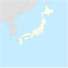
Nishinoshima (Japanese: 西之島, "western island") is a volcanic island located around 940 km (584 mi) south-southeast of Tokyo that is part of the Volcano Islands arc. Nishinoshima is located about 130 km to the west of the nearest inhabited Ogasawara islands, Chichijima Island, hence the name; the other Ogasawara island groups are aligned more to the north–south. The nearest of the other Volcano Islands is over 270 km away, but Nishinoshima is on the alignment of the Volcano Islands.
It was formed by ash from an underwater volcanic eruption. Originally the above-water part of the ridge of an underwater caldera, Nishinoshima was enlarged in 1974 after eruptions created a new section of the island. Another eruption that began in November 2013 further enlarged the island and attracted worldwide attention.[2][3] A volcanic cone soon formed, rising to an estimated height of 142 m (466 ft) by July 2016.[4][5] The eruptions ceased by November 2015, though emissions of volcanic gases continued for several months afterwards. There were further eruptions in 2017,[6] 2018, and in 2019–2020.[7] As of 14 August 2020, it is about 4.1 km2 (1.6 sq mi) and over 2 km (1.2 mi) in diameter and showed evidence of the return of various plants and animal species.[8][1]
- ^ a b Cite error: The named reference
asahi20200828was invoked but never defined (see the help page). - ^ Cite error: The named reference
:2was invoked but never defined (see the help page). - ^ Cite error: The named reference
International Business Timeswas invoked but never defined (see the help page). - ^ "Nishinoshima". Global Volcanism Program. Smithsonian Institution. Retrieved 24 June 2021.
- ^ "西之島|海域火山データベース|海上保安庁 海洋情報部". www1.kaiho.mlit.go.jp. Retrieved 20 December 2019.
- ^ "Nishinoshima island south of Tokyo erupts, lava heads to sea". The Asahi Shimbun. Archived from the original on 29 June 2017. Retrieved 23 April 2017.
- ^ "Nishinoshima: Eruptive History". Global Volcanism Program. Smithsonian Institution. Retrieved 24 June 2021.
- ^ Cite error: The named reference
:4was invoked but never defined (see the help page).
