Back نیژنینقارزک AZB Ніжнеангарск Byelorussian Нижнеангарск CE Nizhneangarsk CEB Nijneangarsk CRH Nižněangarsk Czech Nischneangarsk German Nizhneangarsk Spanish Nižneangarsk Finnish Nijneangarsk French
Nizhneangarsk
Нижнеангарск | |
|---|---|
| Other transcription(s) | |
| • Buryat | Доодо Ангар |
 | |
| Coordinates: 55°46′N 109°31′E / 55.767°N 109.517°E | |
| Country | Russia |
| Federal subject | Buryatia[1] |
| Administrative district | Severo-Baykalsky District[1] |
| Urban-type settlement | Nizhneangarsk Urban-Type Settlement[1] |
| Founded | 1643 |
| Elevation | 460 m (1,510 ft) |
| Population | |
• Total | 5,030 |
| • Capital of | Severo-Baykalsky District,[1] Nizhneangarsk Urban-Type Settlement |
| • Municipal district | Severo-Baykalsky Municipal District[3] |
| • Urban settlement | Nizhneangarsk Urban Settlement[3] |
| • Capital of | Severo-Baykalsky Municipal District,[3] Nizhneangarsk Urban Settlement[4] |
| Time zone | UTC+8 (MSK+5 |
| Postal code(s)[6] | 671710, 671739 |
| OKTMO ID | 81645155051 |
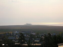
Nizhneangarsk (Russian: Нижнеанга́рск; Russian Buryat: Доодо Ангар, Doodo Angar; Mongolian: Доод Ангар, Dood Angar) is an urban locality (an urban-type settlement) and the administrative center of Severo-Baykalsky District of the Republic of Buryatia, Russia, located at the northern tip of Lake Baikal, 23 kilometers (14 mi) north of Severobaykalsk. As of the 2010 Census, its population was 5,030.[2]
- ^ a b c d e Cite error: The named reference
RBuryatia_admlistwas invoked but never defined (see the help page). - ^ a b Russian Federal State Statistics Service (2011). Всероссийская перепись населения 2010 года. Том 1 [2010 All-Russian Population Census, vol. 1]. Всероссийская перепись населения 2010 года [2010 All-Russia Population Census] (in Russian). Federal State Statistics Service.
- ^ a b c Cite error: The named reference
RBuryatia_munlistwas invoked but never defined (see the help page). - ^ Федеральная служба государственной статистики. Федеральное агентство по технологическому регулированию и метрологии. №ОК 033-2013 1 января 2014 г. «Общероссийский классификатор территорий муниципальных образований. Код 81 645 155». (Federal State Statistics Service. Federal Agency on Technological Regulation and Metrology. #OK 033-2013 January 1, 2014 Russian Classification of Territories of Municipal Formations. Code 81 645 155. ).
- ^ "Об исчислении времени". Официальный интернет-портал правовой информации (in Russian). June 3, 2011. Retrieved January 19, 2019.
- ^ Почта России. Информационно-вычислительный центр ОАСУ РПО. (Russian Post). Поиск объектов почтовой связи (Postal Objects Search) (in Russian)


