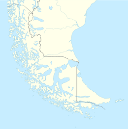
Native name: Isla Noir | |
|---|---|
 | |
| Geography | |
| Coordinates | 54°29′S 73°02′W / 54.483°S 73.033°W |
| Archipelago | Tierra del Fuego |
| Adjacent to | Pacific Ocean |
| Area | 22,500 ha (56,000 acres) |
| Length | 20 km (12 mi) |
| Width | 8 km (5 mi) |
| Highest elevation | 183 m (600 ft) |
| Administration | |
| Region | Magallanes Region |
| Province | Punta Arenas |
| Commune | Punta Arenas |
| Additional information | |
| NGA UFI -893783 | |
Noir Island (Spanish: Isla Noir) is an island located 27 km (17 mi) west of Tierra del Fuego. Cabo Noir (sometimes called "Cape Noir" in English) is the south-western cape of Isla Noir.[1] The island reaches a height of approximately 183 m (600 ft).
- ^ Carteret's voyage round the world, 1766-1769: "Cape Noir, the south-west cape of Noir Island, 54° 31' S, 73° 05' W."

