Back نوردفايكرهاوت Arabic نوردويچكيرهوت ARZ Noordwijkerhout Catalan Gemeente Noordwijkerhout CEB Noordwijkerhout German Noordwijkerhout Esperanto Noordwijkerhout Spanish Noordwijkerhout Basque نوردویکرهات Persian Noordwijkerhout French
Noordwijkerhout | |
|---|---|
Town and former municipality | |
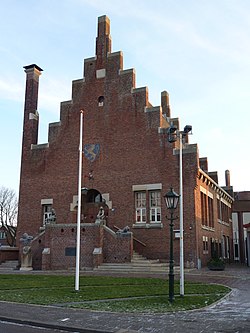
 Former City hall | |
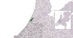
 Location in South Holland | |
| Coordinates: 52°16′N 4°30′E / 52.267°N 4.500°E | |
| Country | Netherlands |
| Province | South Holland |
| Municipality | Noordwijk |
| Area | |
• Total | 23.42 km2 (9.04 sq mi) |
| • Land | 22.61 km2 (8.73 sq mi) |
| • Water | 0.81 km2 (0.31 sq mi) |
| Elevation | 3 m (10 ft) |
| Population (January 2021)[3] | |
• Total | data missing |
| Demonym | Noordwijkerhouter |
| Time zone | UTC+1 (CET) |
| • Summer (DST) | UTC+2 (CEST) |
| Postcode | 2190–2191, 2210–2211 |
| Area code | 0252 |
| Website | www |
Noordwijkerhout (Dutch pronunciation: [ˌnoːrtʋɛikərˈɦʌut] ⓘ) is a town and former municipality in the western part of the Netherlands, in the province of South Holland. The town is currently part of the municipality of Noordwijk and lies in the bulb-growing region (the Duin- en Bollenstreek) of the Netherlands, which is famed for its tulips.
The former municipality of Noordwijkerhout covered an area of 23.42 km2 (9.04 sq mi), of which 0.81 km2 (0.31 sq mi) was water, and had a population of data missing in 2021. It also included the village of De Zilk, which together with the town of Noordwijkerhout became part of the municipality of Noordwijk on 1 January 2019.[4]
- ^ "Kerncijfers wijken en buurten 2020" [Key figures for neighbourhoods 2020]. StatLine (in Dutch). CBS. 24 July 2020. Retrieved 19 September 2020.
- ^ "Postcodetool for 2211CC". Actueel Hoogtebestand Nederland (in Dutch). Het Waterschapshuis. Retrieved 16 August 2013.
- ^ "Bevolkingsontwikkeling; regio per maand" [Population growth; regions per month]. CBS Statline (in Dutch). CBS. 1 January 2021. Retrieved 2 January 2022.
- ^ "Gemeentelijke indeling op 1 januari 2019". CBS (in Dutch). Retrieved 9 December 2019.
