Back أوفالون (ميزوري) Arabic اوفالون ARZ اوفالن، میزوری AZB O'Fallon (Missouri) Catalan ОьФеллон (Миссури) CE O'Fallon (lungsod sa Tinipong Bansa, Missouri) CEB O'Fallon (Missouri) Czech O'Fallon, Missouri Welsh O’Fallon (Missouri) German O'Fallon (Misuri) Spanish
O'Fallon, Missouri | |
|---|---|
 | |
| Motto: Tradition with Vision | |
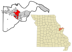
 Location in the state of Missouri | |
| Coordinates: 38°47′04″N 90°43′12″W / 38.78444°N 90.72000°W | |
| Country | United States |
| State | |
| County | St. Charles |
| Metro | Greater St. Louis |
| First Settled | 1856 |
| Incorporated | September 25, 1912 |
| Government | |
| • Type | Mayor-council government |
| Area | |
• City | 30.51 sq mi (79.01 km2) |
| • Land | 30.50 sq mi (79.00 km2) |
| • Water | 0.00 sq mi (0.01 km2) |
| Elevation | 614 ft (187 m) |
| Population (2020) | |
• City | 91,316 |
• Estimate (2023)[4] | 94,074 |
| • Density | 2,993.67/sq mi (1,155.87/km2) |
| • Metro | 2,810,056 (US: 19th) |
| Time zone | UTC−6 (CST) |
| • Summer (DST) | UTC−5 (CDT) |
| ZIP code | 63366, 63368 |
| Area code | 636 |
| FIPS code | 29-54074 |
| GNIS feature ID | 2395303[3] |
| Website | www |
O'Fallon (/oʊˈfælən/ oh-FAL-ən) is a city in St. Charles County, Missouri, United States. It is part of the St. Louis metropolitan statistical area, located along Interstates 64 and 70 between Lake St. Louis and St. Peters. As of the 2020 census, O'Fallon had a population of 91,316, making it the most populous suburb of St. Louis, as well as the most populous municipality in St. Charles County and the 7th most populous in Missouri. O'Fallon's namesake in St. Clair County, Illinois, is also part of the St. Louis region. The two cities are one of the few pairs of same-named municipalities to be part of the same metro area.
- ^ "O'Fallon Elected Officials". City of O'Fallon, Missouri. Retrieved April 24, 2009.
- ^ "ArcGIS REST Services Directory". United States Census Bureau. Retrieved August 28, 2022.
- ^ a b "City of O'Fallon". Geographic Names Information System. United States Geological Survey, United States Department of the Interior. Retrieved August 28, 2024.
- ^ "QuickFacts - O'Fallon city, Missouri". United States Census Bureau. November 3, 2024.

