Back أوركدال Arabic Orkdal BAR ওর্কডাল BPY Orkdal Catalan Orkdal (munisipyo) CEB Orkdal Danish Orkdal German Orkdal Esperanto Orkdal Spanish Orkdal Basque
Orkdal Municipality
Orkdal kommune | |
|---|---|
| Orkedal herred (historic name) Orkedalen herred (historic name) | |
 View of Orkanger | |
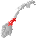
 Trøndelag within Norway | |
 Orkdal within Trøndelag | |
| Coordinates: 63°17′20″N 09°43′34″E / 63.28889°N 9.72611°E | |
| Country | Norway |
| County | Trøndelag |
| District | Orkdalen |
| Established | 1 Jan 1838 |
| • Created as | Formannskapsdistrikt |
| Disestablished | 1 Jan 2020 |
| • Succeeded by | Orkland Municipality |
| Administrative centre | Orkanger |
| Government | |
| • Mayor (2015–2019) | Oddbjørn Bang (Sp) |
| Area (upon dissolution) | |
• Total | 594.30 km2 (229.46 sq mi) |
| • Land | 564.46 km2 (217.94 sq mi) |
| • Water | 29.84 km2 (11.52 sq mi) 5% |
| • Rank | #188 in Norway |
| Highest elevation | 846.7 m (2,777.9 ft) |
| Population (2019) | |
• Total | 12,086 |
| • Rank | #96 in Norway |
| • Density | 20.3/km2 (53/sq mi) |
| • Change (10 years) | |
| Demonym | Orkdaling[2] |
| Official language | |
| • Norwegian form | Neutral |
| Time zone | UTC+01:00 (CET) |
| • Summer (DST) | UTC+02:00 (CEST) |
| ISO 3166 code | NO-5024[4] |
Orkdal is a former municipality in Trøndelag county, Norway. The municipality existed from 1838 until its dissolution in 2020 when it joined Orkland Municipality. It was part of the Orkdalen region. The administrative centre of the municipality was the city of Orkanger. Some of the notable villages in the municipality included Kjøra, Geitastrand, Gjølme, Thamshavn, Fannrem, Vormstad, Svorkmo, and Hoston.

At the time of its dissolution in 2020, the 594-square-kilometre (229 sq mi) municipality was the 188th largest by area out of the 422 municipalities in Norway. Orkdal Municipality was the 96th most populous municipality in Norway with a population of 12,086. The municipality's population density was 20.3 inhabitants per square kilometre (53/sq mi) and its population had increased by 8.3% over the previous 10-year period.[5][6]
Agriculture played a significant role in the municipality. The Thamshavnbanen was used to transport ore from Løkken Verk to the port of Thamshavn, and it is now a vintage railway. The Fannrem concentration camp was located in Fannrem during World War II. Orkanger is one of the main industrial hubs in central Norway. The industry was mainly located around Grønøra Industrial park. The largest companies are Technip Offshore Norge AS, Reinertsen, Washington Mills, and Elkem Thamshavn AS.
- ^ "Høgaste fjelltopp i kvar kommune" (in Norwegian). Kartverket. 16 January 2024. Archived from the original on 12 March 2019.
- ^ "Navn på steder og personer: Innbyggjarnamn" (in Norwegian). Språkrådet.
- ^ "Forskrift om målvedtak i kommunar og fylkeskommunar" (in Norwegian). Lovdata.no.
- ^ Bolstad, Erik; Thorsnæs, Geir, eds. (9 January 2024). "Kommunenummer". Store norske leksikon (in Norwegian). Foreningen Store norske leksikon.
- ^ Statistisk sentralbyrå. "Table: 06913: Population 1 January and population changes during the calendar year (M)" (in Norwegian).
- ^ Statistisk sentralbyrå. "09280: Area of land and fresh water (km²) (M)" (in Norwegian).

