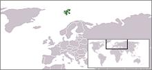

The following outline is provided as an overview of and topical guide to Svalbard:
Svalbard – incorporated territory of the Kingdom of Norway comprising the Svalbard Archipelago in the Arctic Ocean about midway between mainland Norway and the North Pole.[1] The archipelago extends from 74° to 81° North, and from 10° to 35° East. The archipelago is the northernmost part of Norway. Three islands are populated: Spitsbergen, Bear Island and Hopen. The capital and largest settlement is Longyearbyen on Spitsbergen. The Spitsbergen Treaty recognises Norwegian sovereignty over Svalbard and the 1925 Svalbard Act makes Svalbard a full part of the Norwegian Kingdom.
- ^ "Svalbard". The World Factbook. United States Central Intelligence Agency. July 2, 2009. Retrieved July 23, 2009.


