Back نهر بادما Arabic পদ্মা নদী Assamese पदमा नदी Bihari পদ্মা নদী Bengali/Bangla Padma Catalan Padma (řeka) Czech Падма CV Padma German Padmo Esperanto Río Padma (Bangladés) Spanish
| The Padma River পদ্মা নদী | |
|---|---|
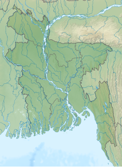
 Padma River in Bangladesh | |
| Location | |
| Countries | Bangladesh |
| Districts | |
| Physical characteristics | |
| Source | |
| • location | Bifurcation of the Ganges at Giria, India, and The Gangotri Glacier in the middle of Himalayans |
| Mouth | |
• location | Bay of Bengal |
| Length | 356 kilometres (221 mi)[1] |
| Discharge | |
| • average | Annual average:
During monsoon season:
During dry season:
|
| Basin features | |
| River system | Ganges River System |
| Bridges | Padma Bridge Lalon Shah Bridge Hardinge Bridge |

The Padma (Bengali: পদ্মা, romanized: Padmā Pôdma) is a major river in Bangladesh. It is the eastern and main distributary of the Ganges, flowing generally southeast for 356 kilometres (221 mi) to its confluence with the Meghna River near the Bay of Bengal.[1] The city of Rajshahi is situated on the banks of the river.[2] Since 1966, over 66,000 hectares of land has been lost to erosion of the Padma.[3]
- ^ a b Allison, Mead A. (Summer 1998). "Geologic Framework and Environmental Status of the Ganges-Brahmaputra Delta". Journal of Coastal Research. 13 (3). Coastal Education & Research Foundation, Inc.: 826–836. JSTOR 4298836.
- ^ Hossain ML, Mahmud J, Islam J, Khokon ZH and Islam S (eds.) (2005) Padma, Tatthyakosh Vol. 1 and 2, Dhaka, Bangladesh, p. 182 (in Bengali).
- ^ "Over 66,000 hectares lost to Padma since 1967: NASA report". The Daily Star. Retrieved 14 September 2018.
